
Mid-March Blizzard Dumps Up to 17 Inches in Parts of South Metro, Causes Major Travel Disruptions Across Minnesota and Wisconsin
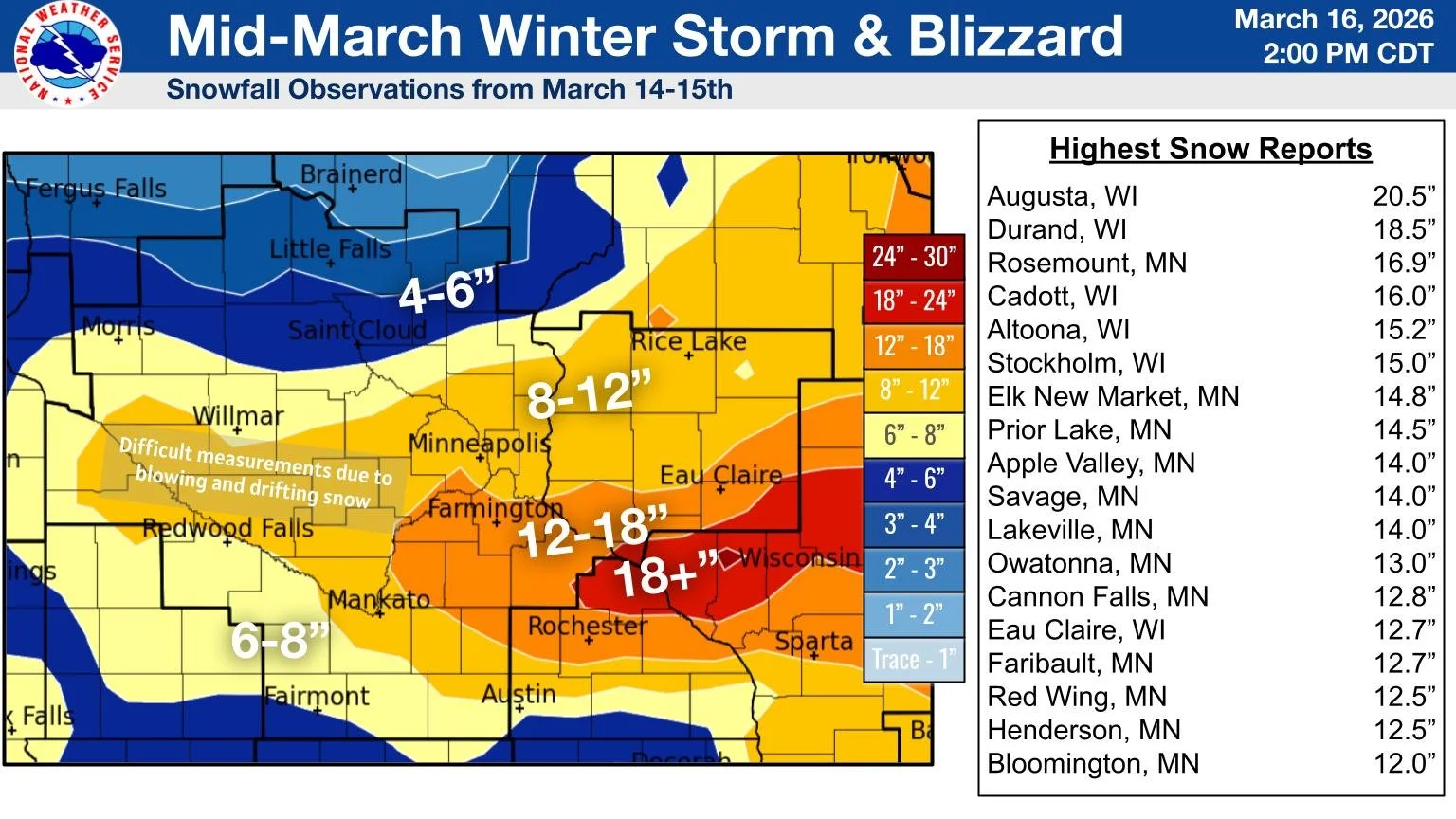
Snowfall observations from March 14-15th, 2026, provided by the NWS Twin Cities, Minnesota.
Published: March 16, 2026.
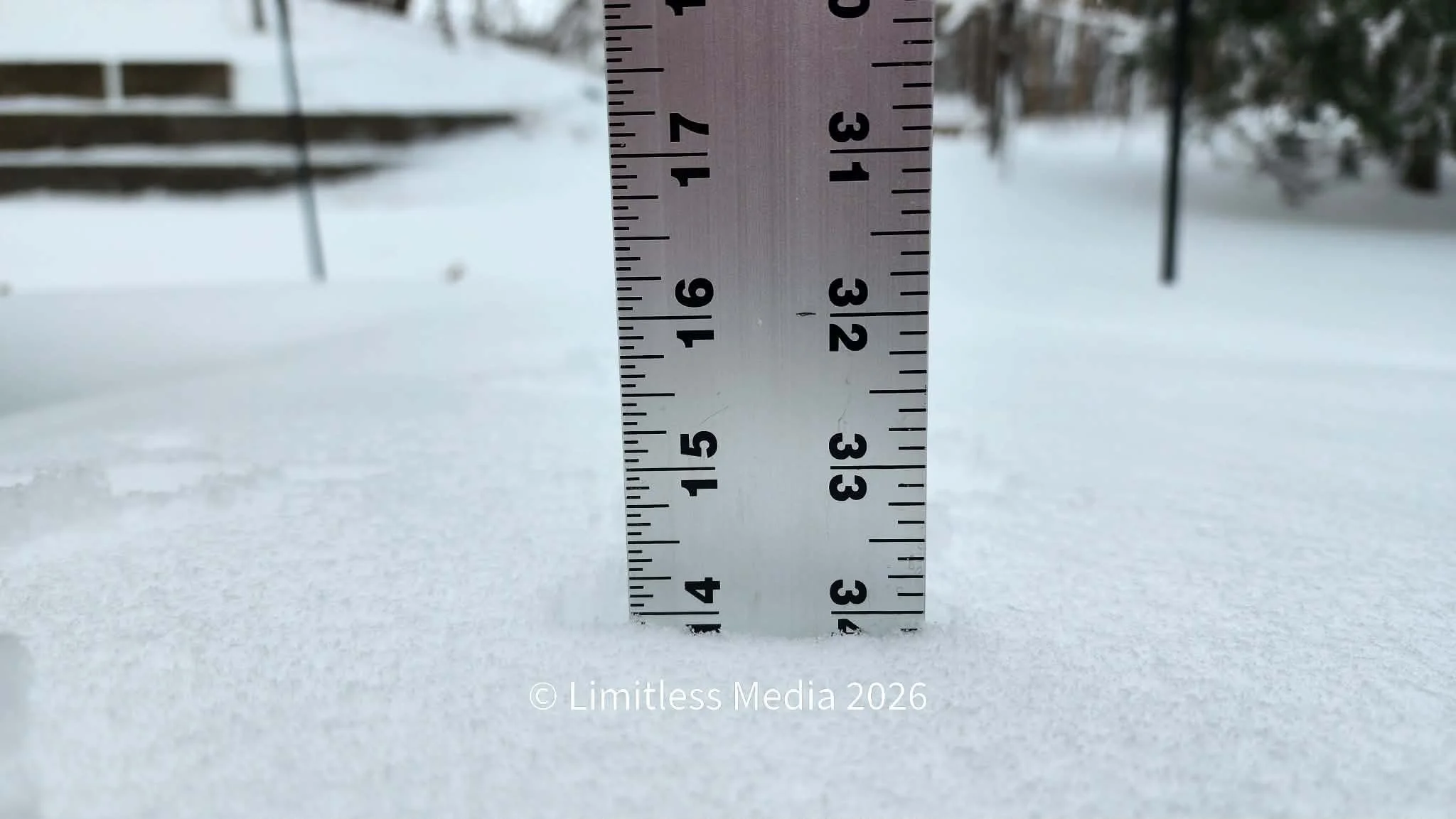
TWIN CITIES, MINNESOTA - A powerful mid-March winter storm brought blizzard conditions, heavy snowfall, and widespread travel disruptions across Minnesota and western Wisconsin over the weekend of March 14–15, 2026, with some communities in the southern Twin Cities metro receiving nearly 17 inches of snow.
According to the National Weather Service, the heaviest snow fell in a band stretching from the southern Twin Cities metro through Rochester and eastward into western Wisconsin. Snow totals across this corridor ranged from roughly 12 to 18 inches, with localized areas approaching two feet in western Wisconsin.
Southern Metro Among Hardest Hit
Several communities in Dakota and Scott counties reported some of the highest snowfall totals in Minnesota during the storm. Among the notable reports:
Rosemount: 16.9 inches
Elko New Market: 14.8 inches
Prior Lake: 14.5 inches
Apple Valley: 14.0 inches
Savage: 14.0 inches
Lakeville: 14.0 inches
Other Minnesota communities reporting significant snowfall included Owatonna (13.0 inches), Cannon Falls (12.8 inches), Faribault (12.7 inches), and Red Wing (12.5 inches).
Across the border in Wisconsin, totals were even higher in some areas. Augusta, Wisconsin, recorded 20.5 inches, while Durand measured 18.5 inches.

Blizzard Conditions Cause Major Travel Impacts
The storm produced not only heavy snow but also powerful winds that created blizzard conditions, significantly reducing visibility and causing severe travel hazards across the region. Officials reported particularly dangerous conditions along Interstate 94 between Eau Claire and Osseo, Wisconsin, where multiple vehicles became stranded during the height of the storm on Sunday.
In southern Minnesota, hazardous conditions forced the Minnesota Department of Transportation (MnDOT) to close several major highways:
Interstate 35 southbound from Albert Lea to the Iowa border
Interstate 90 across portions of southern Minnesota
The closures were necessary due to extremely poor visibility, heavy drifting snow, and stalled or stranded vehicles.
Storm Adds to Already Above-Normal Snow Season
The significant snowfall from the mid-March storm pushed seasonal snowfall totals at Minneapolis–Saint Paul International Airport further above average.
As of mid-March, MSP has recorded 47.5 inches of snow since July 1, slightly above the normal seasonal value of 44.4 inches. By comparison, only 25.6 inches had fallen by the same time last winter.
Recent seasonal totals at MSP include:
2024–2025: 29.4 inches
2023–2024: 29.5 inches
2022–2023: 90.3 inches
2021–2022: 50.2 inches
2020–2021: 48.7 inches
Since 1999, the average seasonal snowfall has been approximately 50.7 inches, with the snowiest winter during that period occurring in 2022–2023 (90.3 inches), while the least snowy season was 2011–2012 (22.3 inches).
March Historically Active for Major Snowstorms
Historical records maintained by the Minnesota Department of Natural Resources (DNR) show that March is one of the most active months for major snowstorms in the Twin Cities.
Since record-keeping began in 1884, seven of the 25 largest snowfall events in the Twin Cities have occurred during March. The list includes well-known historic storms such as:
1991 Halloween Blizzard: 28.4 inches (largest on record)
1985 Thanksgiving Weekend Blizzard: 21.1 inches
January 1982 storms: over 20 inches
Many of these storms lasted multiple days, as large low-pressure systems rotated waves of moisture and energy through the region. Climatology data shows that the transition months of November and March tend to produce the most extreme snow events, accounting for more than half of the top-ranked storms on record.
A Reminder That Winter Isn’t Over Yet
Despite being late in the season, the mid-March storm served as another reminder that significant winter weather remains possible well into spring in Minnesota and Wisconsin. Heavy snow, strong winds, and drifting created near-whiteout conditions in some areas, leading to stranded motorists and highway closures across parts of the region.
While temperatures are expected to gradually warm in the coming weeks, meteorologists note that large late-season storms are not unusual for Minnesota, where March remains one of the most volatile months for winter weather.
Written by: Will Wight
Snowfall map provided by the NWS Twin Cities.