
Minnesota State Fair Opening Weekend Forecast: Pleasant Start Before Storm Chances Increase
Published: August 27, 2026
TWIN CITIES, MINNESOTA: The Minnesota State Fair is kicking off with some excellent late-summer weather, but fairgoers heading to the grounds this weekend will want to keep an eye on the sky as rain and thunderstorms become increasingly likely.
Thursday afternoon and Friday are expected to provide the best weather of the stretch, while Saturday brings the greatest potential for rain and thunderstorms. Warm, humid and somewhat unsettled conditions are then expected Sunday.
Thursday, Aug. 27: Sunny and Pleasant
Opening day will feature nearly ideal weather for those heading to the Minnesota State Fair. Temperatures Thursday afternoon will climb into the mid-to-upper 70s, reaching around 79 degrees by 4 to 5 p.m. Sunny skies and relatively low humidity will make for comfortable conditions throughout the afternoon. Winds will remain light at around 5 to 8 mph, with occasional gusts approaching 14 mph.
Those planning to spend Thursday evening at the fairgrounds shouldn't have to worry about rain, with dry conditions expected to continue through the evening.
Fair Forecast: Sunny, comfortable and dry. Temperatures in the 70s.
Friday, Aug. 28: Best Weather of the Stretch
Friday looks to be the standout day of the opening weekend. The morning will start cool and crisp, with temperatures around 56 degrees, before quickly warming under mostly sunny skies. Afternoon temperatures are expected to reach around 82 degrees. Winds will remain light at approximately 2 to 6 mph, and no rain is expected. A few additional clouds may begin moving into the area Friday evening ahead of the next weather system, but conditions should remain dry through the day.
For anyone deciding which day to make a trip to the fair, Friday currently offers the best combination of sunshine, comfortable temperatures and dry weather.
Fair Forecast: Mostly sunny and dry. High near 82 degrees.
Saturday, Aug. 29: Rain and Thunderstorms Likely
Saturday will bring a significant change in the weather and appears to be the most unsettled day of opening weekend. Rain is expected to begin overnight Friday into Saturday, with periods of rain possible from approximately 1 a.m. through Saturday morning. The chance for thunderstorms will then increase late Saturday morning and into the afternoon, with storms most likely between approximately 11 AM to 4-5 PM. Some thunderstorms could produce gusty winds, potentially reaching 22 to 28 mph, along with periods of heavier rain and lightning. Around 0.10 to 0.15 inches of rainfall is currently expected. Temperatures will range from a morning low around 65 degrees to an afternoon high near 78 degrees.
At this time, severe weather is not indicated, but anyone attending the fair Saturday should remain weather-aware, especially with thunderstorms capable of producing dangerous lightning. Fairgoers should consider bringing rain gear and have a plan for seeking shelter if thunderstorms approach the fairgrounds.
Fair Forecast: Periods of rain with thunderstorms likely, especially late morning through the afternoon. High near 78 degrees.
Sunday, Aug. 30: Warmer, Humid and Unsettled
Sunday will turn noticeably warmer and more humid. Morning temperatures will start around 69 degrees, with mostly cloudy skies and the possibility of lingering light showers. Some clearing is expected during the afternoon, allowing temperatures to climb into the low-to-mid 80s. The forecast high is around 84 degrees, but increasing humidity could make it feel closer to 85 to 88 degrees during the afternoon. Scattered showers will remain possible throughout the afternoon and evening, although Sunday does not currently appear as consistently wet as Saturday. An additional 0.05 to 0.10 inches of rainfall could fall through the day. Winds should remain relatively light at around 6 to 7 mph.
Fair Forecast: Warm and muggy with scattered showers possible. High near 84 degrees, with heat-index values potentially reaching the upper 80s.
Early Monday, Aug. 31: Muggy With Light Rain Possible
The warm and humid weather will continue into early Monday morning. Temperatures are expected to remain in the low-to-mid 70s overnight, with humidity approaching 90% or higher. Mostly cloudy skies and occasional light rain will remain possible through approximately 6 AM.
While rainfall amounts should be minimal, the combination of warm temperatures and high humidity could make for an uncomfortable overnight period for anyone camping, working, or preparing for another day at the fairgrounds.
Opening Weekend at a Glance
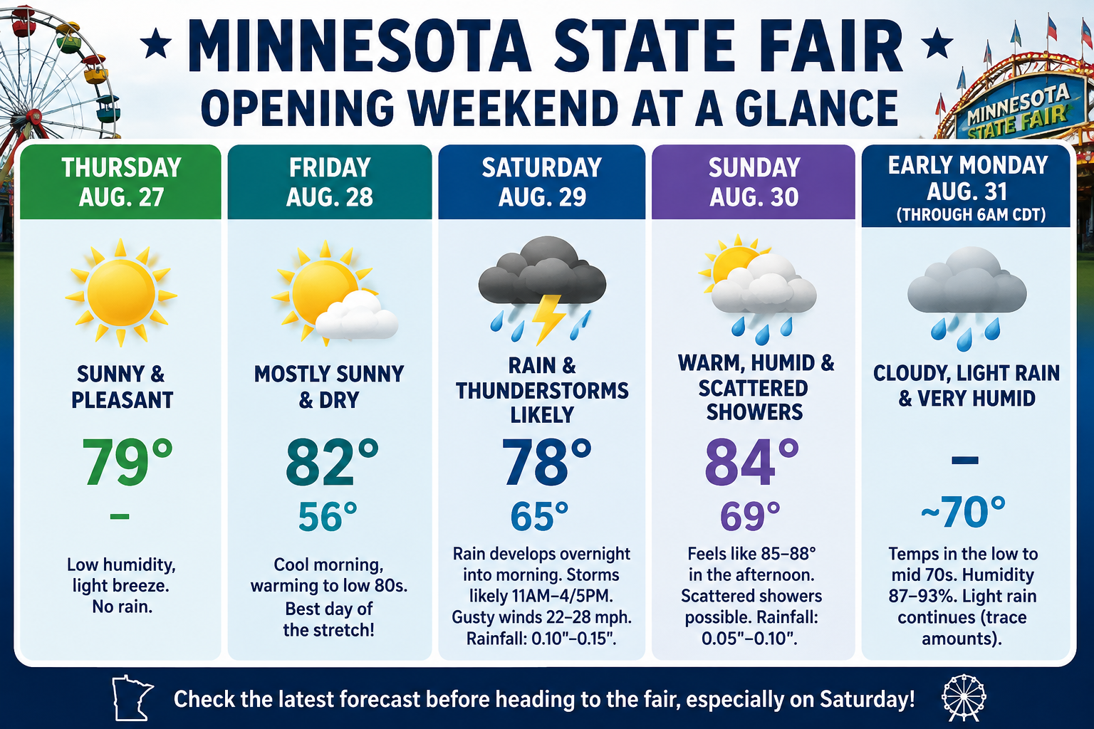
Overall, Thursday afternoon and Friday will offer the most favorable weather for the Minnesota State Fair, with sunshine, comfortable temperatures and dry conditions.
Saturday is the day fairgoers will want to watch most closely, as rain and thunderstorms could affect outdoor activities for portions of the day. Sunday improves somewhat but remains warm, humid and unsettled with additional scattered showers possible.
Those heading to the fair this weekend should continue to check the latest forecast before leaving home, particularly on Saturday, as the exact timing and coverage of thunderstorms can change as the weekend approaches.
