
Severe Storms Possible Across Twin Cities Thursday Evening; Large Hail, Damaging Winds Main Threat
Published: August 20, 2026
TWIN CITIES, MINNESOTA: The Twin Cities metro and portions of Minnesota could see a few rounds of thunderstorms Thursday, with some storms capable of producing large hail and damaging wind gusts during the afternoon and evening hours.
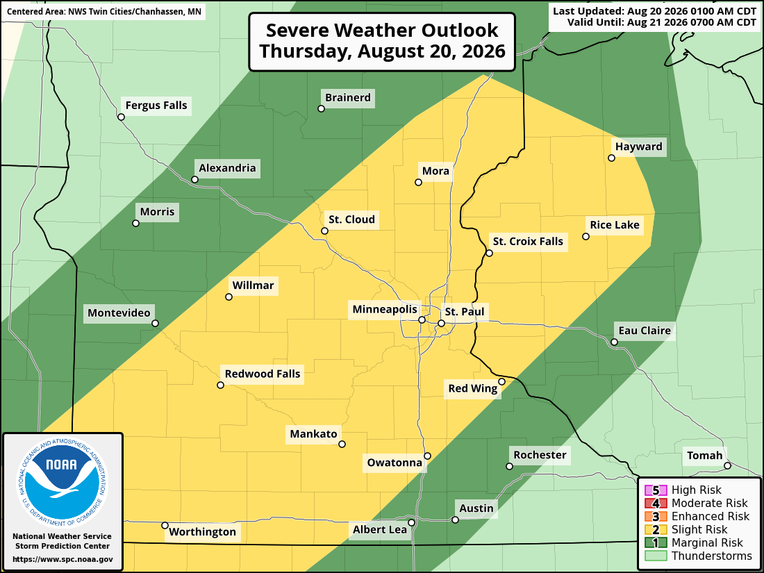
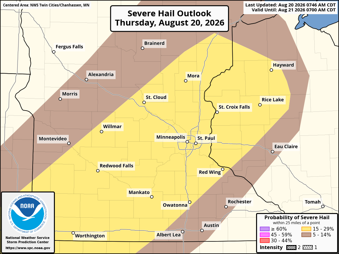
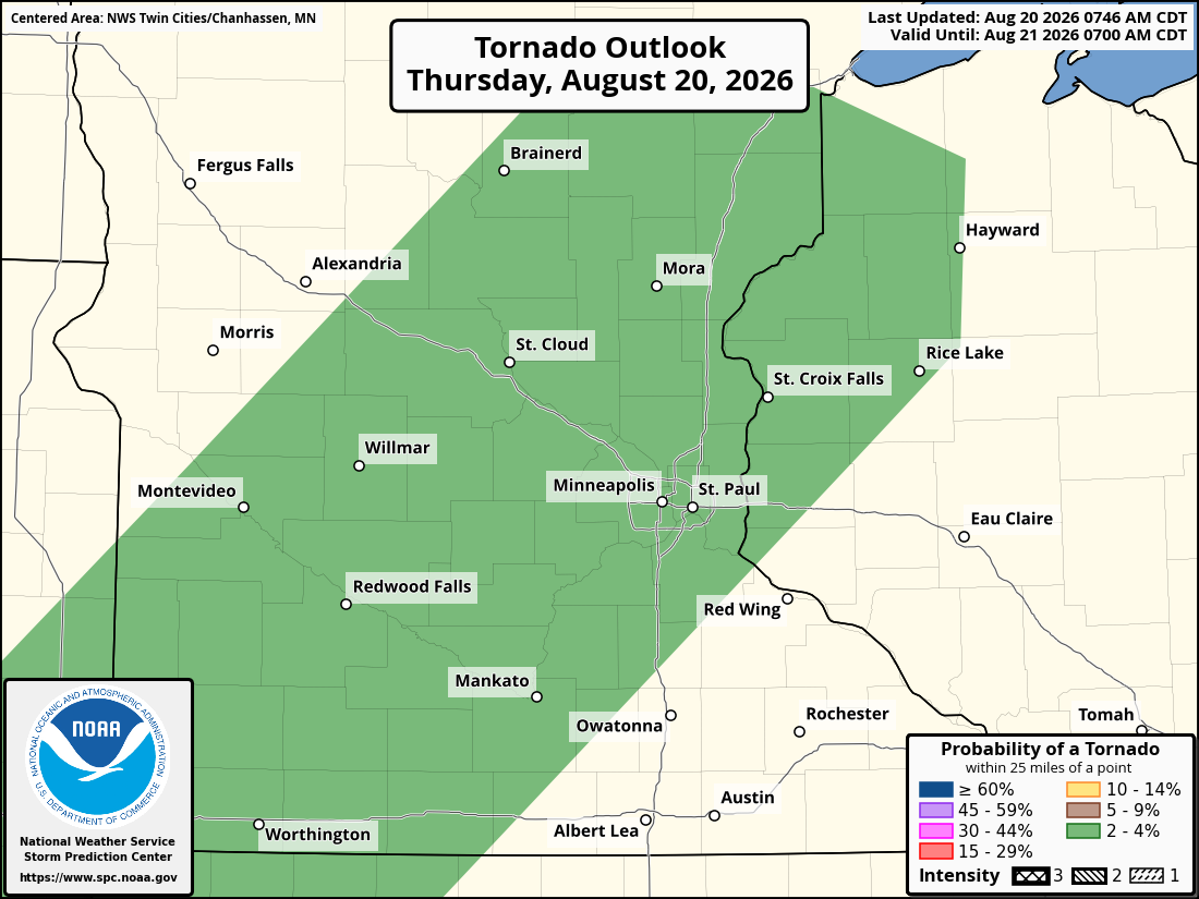
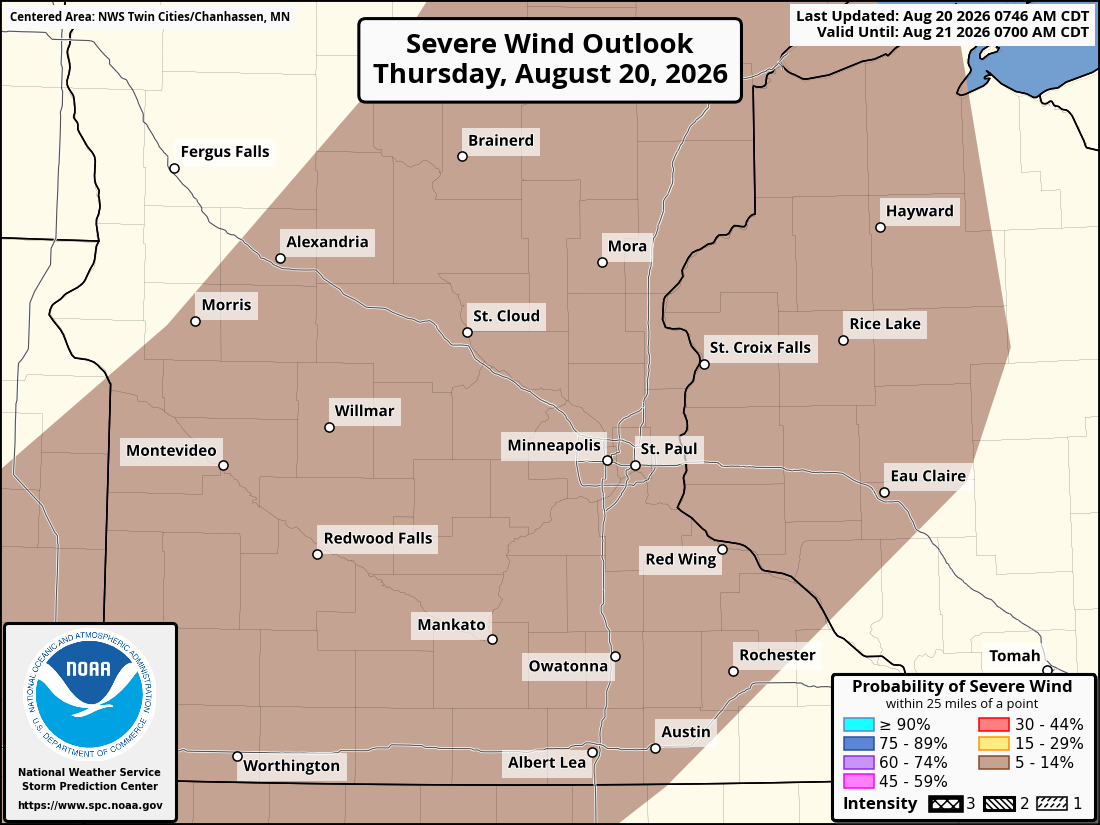
The Storm Prediction Center has placed the Twin Cities metro and surrounding areas under a Slight Risk, Level 2 out of 5, for severe thunderstorms. The primary threats from any severe storms that develop will be large hail and damaging winds, although an isolated tornado cannot be completely ruled out.
While thunderstorms are possible at several points during the day, severe weather is not expected to be widespread, and not everyone will necessarily see a thunderstorm.
First Round of Showers and Storms Possible Late Morning Into Afternoon
The first opportunity for precipitation comes as a surface low develops and winds turn back toward the southwest, helping transport additional low-level moisture into Minnesota. Isolated to scattered showers and embedded thunderstorms are expected to develop across portions of northern and central Minnesota during the morning, which are currently ongoing. The initial focus is expected to be primarily north of the Twin Cities, including areas from around Alexandria east toward Mille Lacs.
However, some scattered showers and embedded thunderstorms could move through portions of the Twin Cities metro beginning around 11 a.m. to noon Thursday, generally progressing from northwest to southeast into the afternoon. This initial activity could continue through approximately 4 to 5 p.m. across the Twin Cities metro, although coverage is expected to be scattered, meaning some communities may receive rain while others remain dry.
Cloud cover present during the morning is expected to gradually diminish through the day. Increasing sunshine would make the atmosphere more unstable ahead of a cold front moving southeast across Minnesota.
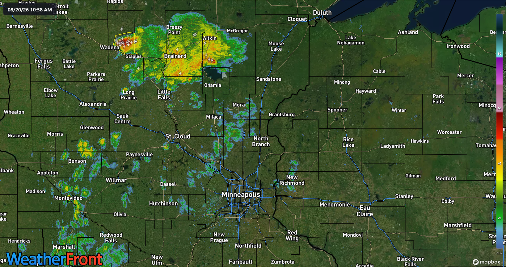
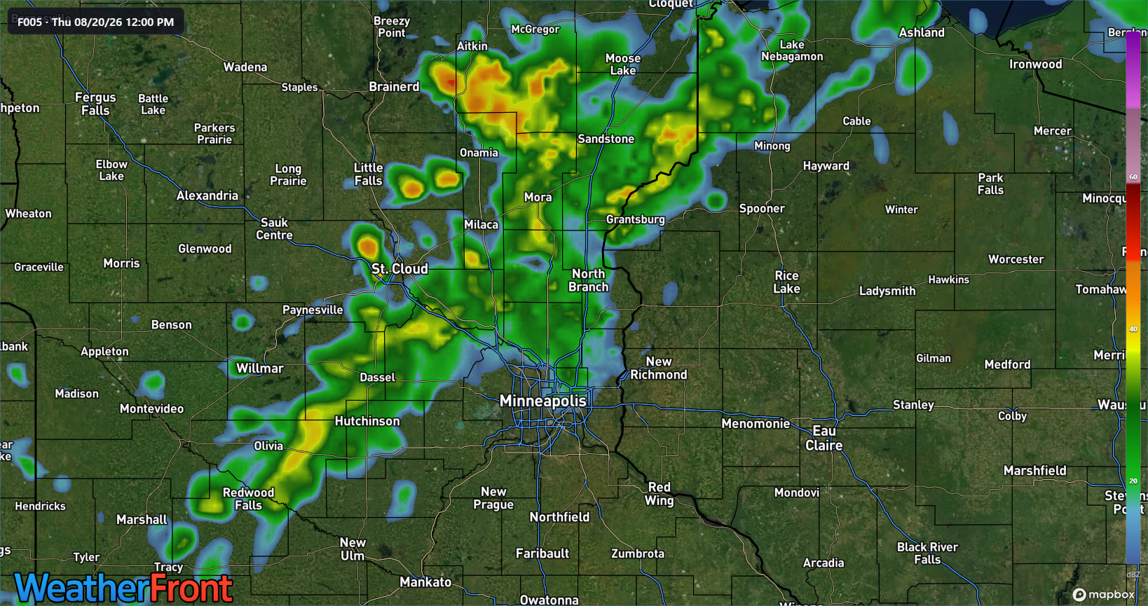
Image #1: Current radar as of 10:58 am showsing ongoing scattered showers and storms and a severe warning near Wadena, MN.
Image #2: 12Z HRRR guidance showing a projection of scattered showers and storms working into the northern Twin Cities metro around that time.
Stronger Storms Could Develop During Evening
Attention then turns to a cold front expected to move southeast through Minnesota during the afternoon and evening. Scattered thunderstorms are forecast to develop along the boundary in an environment that could support some stronger storms. Ample instability anddeep-layer wind shear should be enough support for organized thunderstorms, and could allow an isolated or scattered strong to severe thunderstorm to develop.
Thunderstorms are forecast to begin developing by approximately 5 p.m. Thursday, generally from the Brainerd area southwest toward Benson, with additional development expected through 8-9 p.m. to the west-northwest of the Twin Cities metro into the Saint Cloud area, that will eventually work into the Twin Cities metro.
Some of the initial thunderstorms could become strong to severe, with large hail and damaging winds representing the primary concerns. Current forecast trends suggest the storms may begin weakening as they approach the northern Twin Cities metro, but residents should continue monitoring conditions as the timing and intensity could change.
Based on current forecast trends, thunderstorms are should be reaching portions of the northwest and northern Twin Cities metro at approximately 8 p.m., with activity continuing across the area through roughly 10 to 12 a.m. Friday. There remains a possibility that some of these storms could maintain enough strength to produce severe weather as they move into the metro.
The exact timing and strength of the storms will depend heavily on how the atmosphere evolves throughout Thursday, including the amount of instability that develops and how earlier showers and thunderstorms affect conditions ahead of the evening activity.
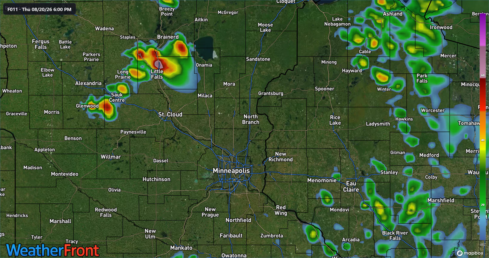
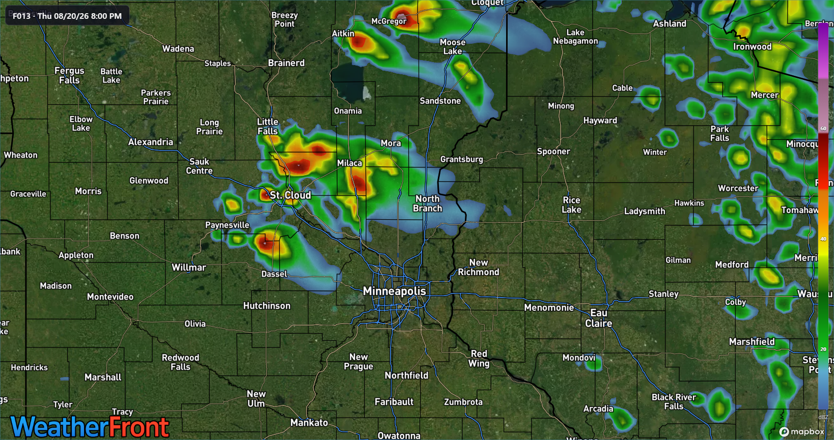
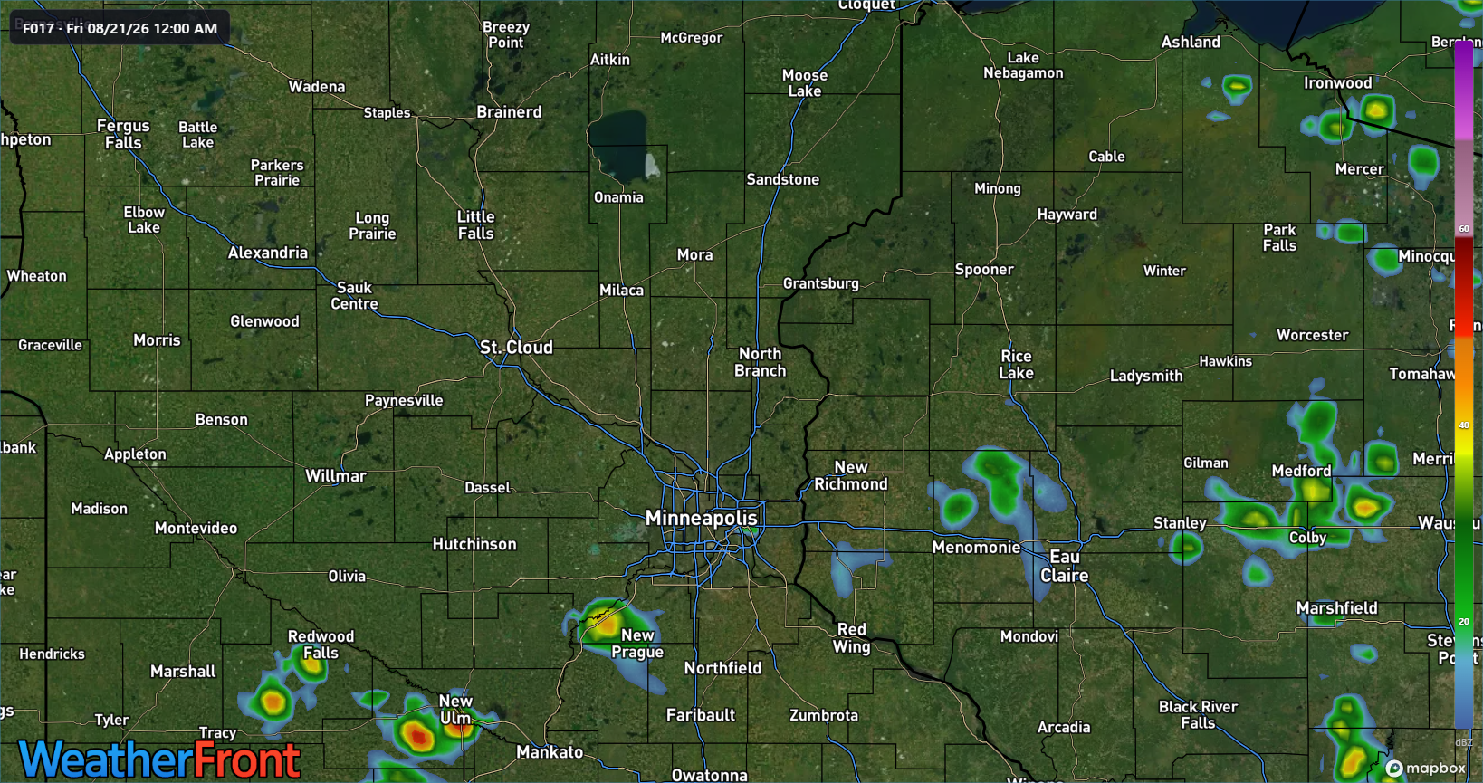
Image #1: 12Z HRRR guidance at 6 PM showing storms developing up near the Brainerd to Sauk Centre area.
Image #2: 12Z HRRR guidance at 8 PM showing additional storms developing just west-northwest of the Twin Cities around the Saint Cloud area.
Image #3: 12Z HRRR guidance at 12 AM Friday showing what is left of the isolated to scattered shower and storm activity around the Twin Cities metro area.
Large Hail, Damaging Winds Are Primary Concerns
For the Twin Cities metro area, large hail and damaging wind gusts as the primary hazards associated with the strongest storms. An isolated tornado cannot be completely ruled out, but the overall tornado threat appears lower than the hail and damaging wind threat.
The Slight Risk designation does not mean severe weather will occur everywhere within the highlighted area. Rather, it indicates conditions are favorable enough that scattered severe thunderstorms could occur within or near the risk area.
Thursday's General Twin Cities Storm Timeline
Based on current forecast guidance:
11 a.m. to 5 p.m.: Scattered showers and embedded thunderstorms could move northwest to southeast through portions of the Twin Cities and surrounding areas. Not everyone will see rain.
Around 5 p.m.: Additional thunderstorms are expected to develop farther northwest, generally from Brainerd toward Benson. Some could initially become strong to severe.
Early evening: Storms move southeast toward the Twin Cities, potentially weakening as they approach the northern metro.
Around 8 to 9 p.m.: Another area of thunderstorms could develop from around St. Cloud southwestward. Some storms could initially be strong to severe.
Approximately 8 to 12 a.m. Friday: Thunderstorms could move through portions of the Twin Cities metro. A strong or severe storm remains possible, with large hail and damaging winds the main concerns.
Thunderstorm timing can vary depending on how storms develop upstream, and earlier storms can significantly alter the environment available to later storms. Residents across the Twin Cities should remain weather-aware Thursday afternoon and evening and have multiple ways to receive weather warnings, particularly if spending time outdoors.
Limitless Media will continue monitoring the potential for severe weather across the Twin Cities metro and provide updates as storms develop.
