
Severe Storm Threat Possible Across Twin Cities on Thursday
Published: April 22, 2026
TWIN CITIES, MINNESOTA: A round of potentially strong-to-severe thunderstorms will be possible as scattered showers and storms move across the Twin Cities and much of southern Minnesota on Thursday, bringing the threat of large hail, damaging winds, heavy rainfall, and even an isolated tornado.
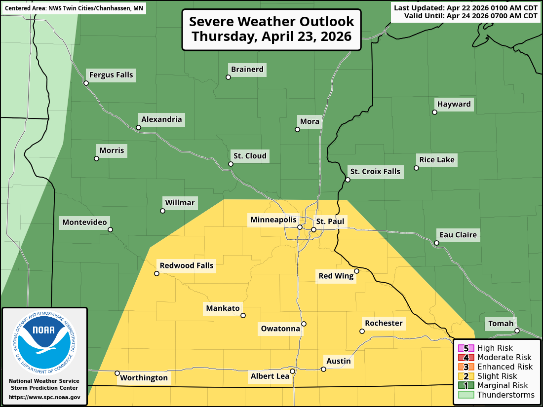
The Storm Prediction Center has placed the Twin Cities metro under a Slight Risk (Level 2 of 5) for severe weather, with areas farther north under a Marginal Risk (Level 1 of 5).
Timing and Setup
As a strengthening low-pressure system tracks across the northern Plains, a cold front will push east out of the Dakotas on Thursday morning. A “cap” in the atmosphere may delay storm development early in the day, but by late morning into the afternoon, increasing lift along the front is expected to break the “cap,” triggering thunderstorms. Storms will then spread eastward through the afternoon and evening, impacting the Twin Cities during peak daytime hours (during the afternoon).
Warm, moist air moving north into southern Minnesota will fuel instability, allowing storms to intensify as they develop to support the threat of strong to severe storms.
Severe Concerns
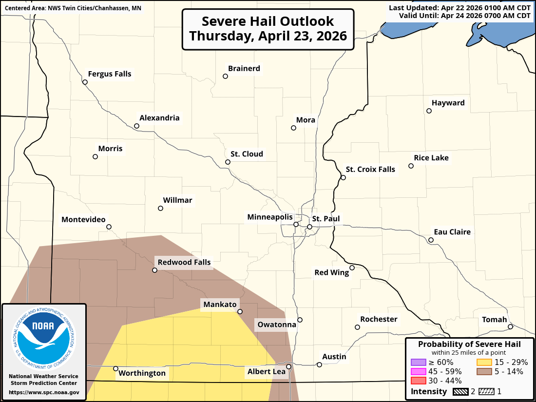
The main concern with early storm development is large to very large hail, especially with any storms that remain more isolated early in the event.
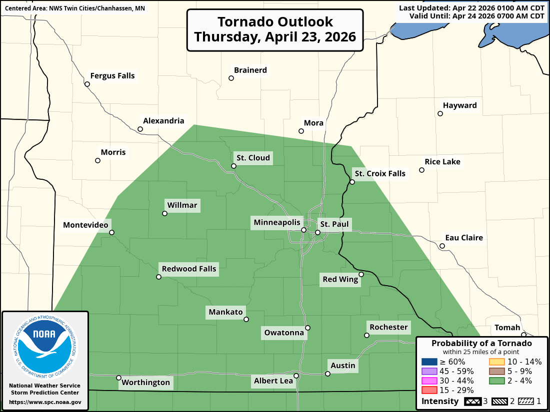
While not the primary risk, an isolated tornado or two cannot be ruled out, particularly if individual storms become more organized. Modest wind shear and low-level wind curvature could allow for brief tornado development. The overall tornado risk is expected to be higher farther south, but still non-zero in the Twin Cities.
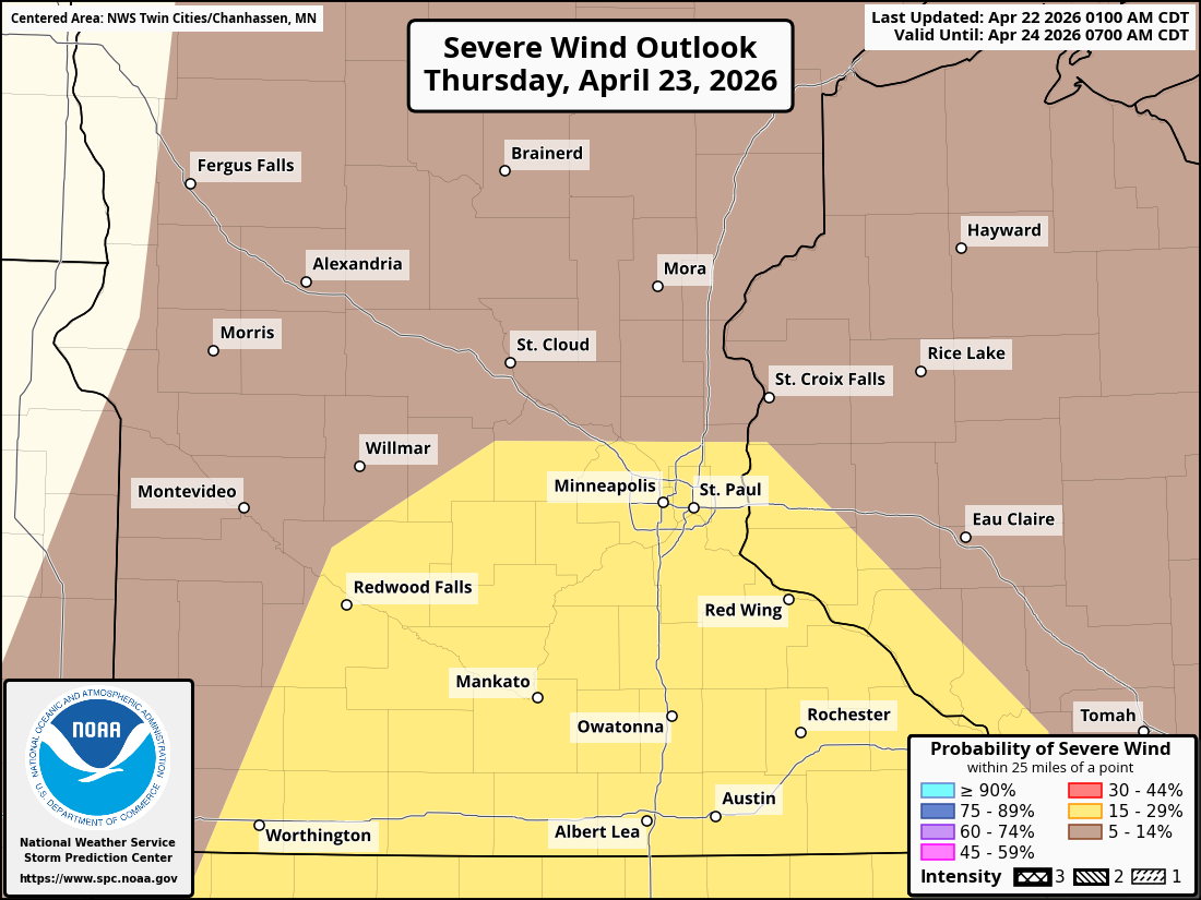
As the afternoon progresses, storms are expected to merge into bowing lines, shifting the primary hazard to a more damaging straight-line wind threat. Storms could organize into linear segments or squall lines, with wind gusts that may increase as the system strengthens into the evening hours. which is likely to be the main threat across the Twin Cities metro.
Heavy Rainfall and Localized Flooding
In addition to severe weather, heavy rain is becoming an increasing concern.
Rainfall totals are expected to vary:
0.25"–0.50" in western Minnesota
0.5"–1" along the I-35 corridor (including the Twin Cities)
1"+ possible in eastern Minnesota and western Wisconsin
Localized areas, especially east of I-35, could see over 1.5 inches of rain, which may lead to brief flooding in low-lying or poor drainage areas.
What to Watch For
Residents across the Twin Cities should be prepared for rapidly changing conditions on Thursday afternoon and evening.
Key things to monitor:
Weather alerts and warnings issued by the National Weather Service
Sudden changes in sky conditions, including darkening clouds or approaching shelf clouds
Hail and strong winds are developing quickly with little warning
Bottom Line
Risk Level: Marginal (1/5) to Slight (2/5)
Main Threat: Large hail
Other Risks: Damaging winds, heavy rain, isolated tornado
Timing: Late morning through evening, peaking in the afternoon
While this is not expected to be a widespread high-end severe weather outbreak, conditions are favorable for scattered strong-to-severe storms.