
Weather News
Categories
- Weather 105
- Minnesota 80
- Dakota County 45
- Scott County 43
- Across the State 41
- Weather Update 35
- Severe Weather 30
- National 13
- National News 12
- Space Weather 10
- International 8
- Weather Alert 6
- Hennepin County 4
- Severe Weather Awareness 4
- Tropical Weather 3
- Illinois 2
- Ramsey County 2
- Burnsville 1
- Carver County 1
- Iowa 1
- Regional News 1
- Travel 1
- Washington County 1
- Winter Weather 1
- Wisconsin 1
Archive
- March 2022 3
- April 2022 1
- May 2022 1
- August 2022 1
- October 2022 5
- November 2022 6
- December 2022 4
- January 2023 3
- March 2023 1
- June 2023 4
- July 2023 4
- August 2023 3
- October 2023 1
- November 2023 1
- February 2024 3
- July 2024 1
- September 2024 1
- November 2024 2
- December 2024 5
- January 2025 1
- February 2025 2
- March 2025 1
- April 2025 2
- May 2025 2
- August 2025 1
- November 2025 5
- December 2025 4
- January 2026 4
- February 2026 2
- March 2026 8
- April 2026 7
- May 2026 3
- June 2026 9
- July 2026 1
- August 2026 2
- September 2026 4
- October 2026 3
Do you have a tip for a breaking news story, an update for an already-posted story, or an upcoming event you think we should cover? Let us know!
Please send us an email: tips@limitless-news.com
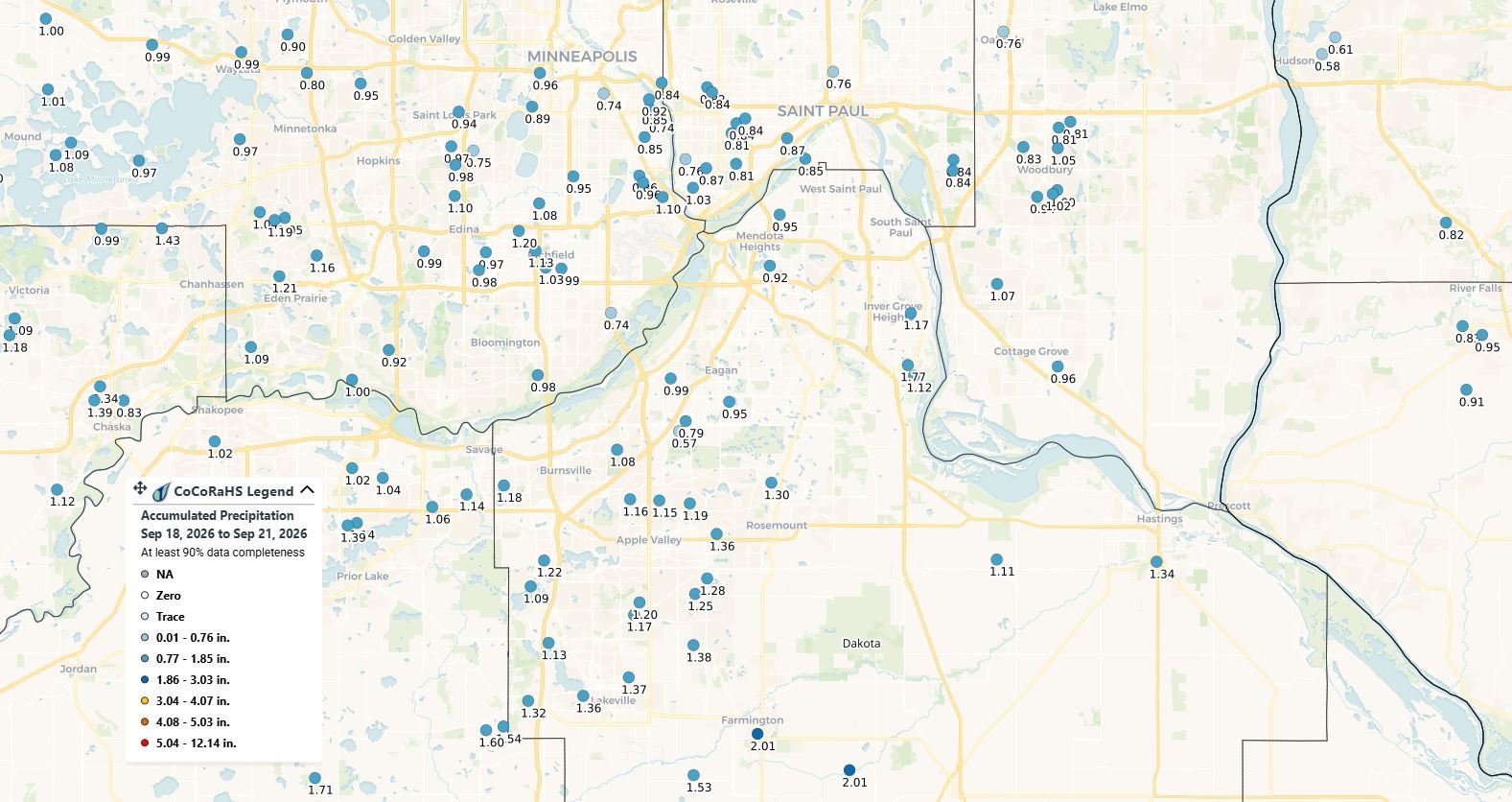
Weekend Rain Delivers Widespread Soaking Across Twin Cities, But Drought Deficits Remain
Weekend rainfall brought 1 to 2 inches across much of the Twin Cities, with some areas of Dakota County receiving more than 2 inches, providing some drought relief.
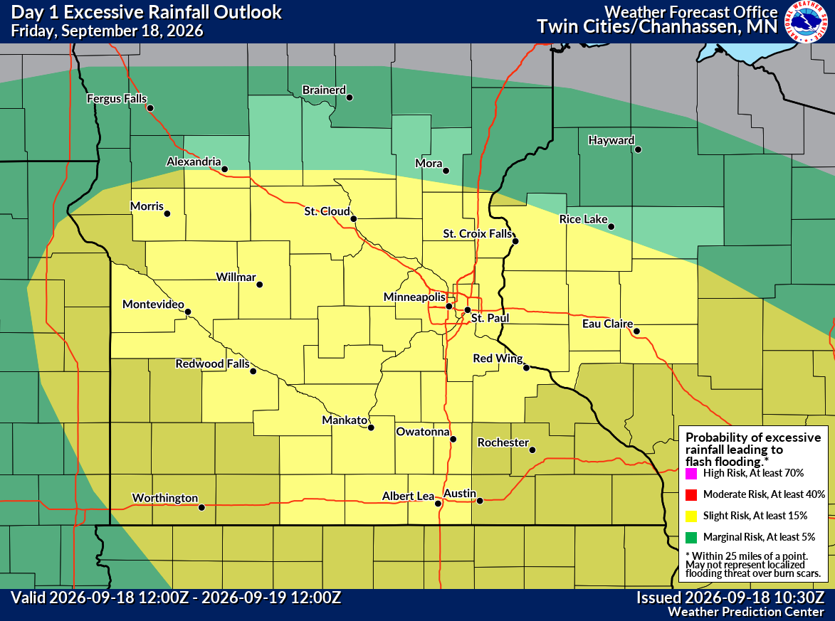
Heavy Rain Targets Twin Cities Friday, With Flooding Concerns Increasing Across Southern Minnesota
Heavy rain is expected across the Twin Cities Friday, with 1 to 2 inches possible across much of the metro. A greater flooding and thunderstorm threat develops across southern Minnesota Friday night.
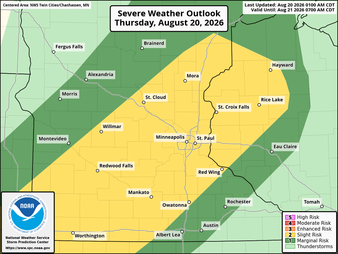
Severe Storms Possible Across Twin Cities Thursday Evening; Large Hail, Damaging Winds Main Threat
Severe thunderstorms could impact the Twin Cities Thursday evening, with large hail and damaging winds possible. Multiple rounds of storms are forecast.
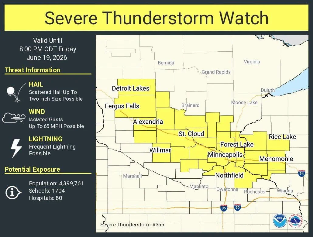
Severe Thunderstorm Watch Issued for Twin Cities Area Until 8 PM Friday
A Severe Thunderstorm Watch has been issued for much of central and east-central Minnesota, including the Twin Cities metropolitan area, until 8:00 PM CDT Friday, June 19, 2026.
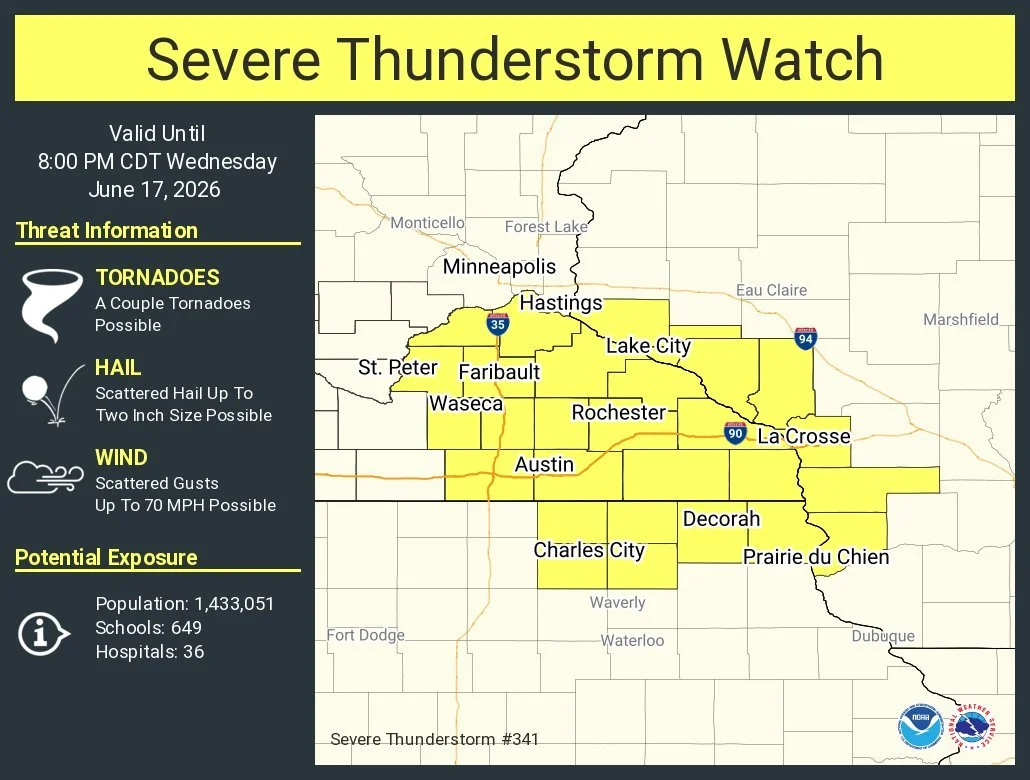
Severe Thunderstorm Watch Issued for Dakota County and Portions of Southeast Minnesota Until 8 PM Wednesday
The National Weather Service has issued Severe Thunderstorm Watch 341 until 8 PM Wednesday for Dakota County and portions of southern Minnesota. Damaging winds up to 70 mph, large hail up to 2 inches, and isolated tornadoes are possible.
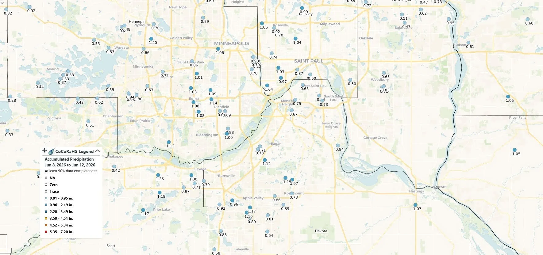
Scattered Storms Possible Today Before Cooler, Dry Weekend Settles Into the Twin Cities
Twin Cities residents can expect scattered showers and thunderstorms Friday evening before cooler, drier weather arrives for the weekend. Most metro communities received 0.50 to 1.20 inches of rain this week, providing much-needed relief from ongoing drought conditions across parts of Minnesota.
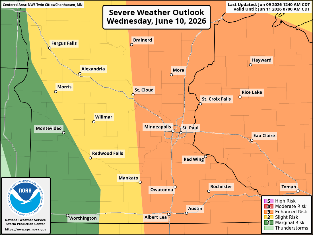
Severe Weather Threat Targets Twin Cities and Southern Minnesota Through Wednesday; Strong Tornadoes, Large Hail, and Damaging Winds Possible
Severe thunderstorms are expected across the Twin Cities, eastern Minnesota, and western Wisconsin on Tuesday night and Wednesday, bringing threats of large hail, damaging winds over 75 mph, strong tornadoes, torrential rainfall, and localized flash flooding. Forecasters warn some storms could produce hail larger than 2 inches and rainfall rates exceeding 2 inches per hour.
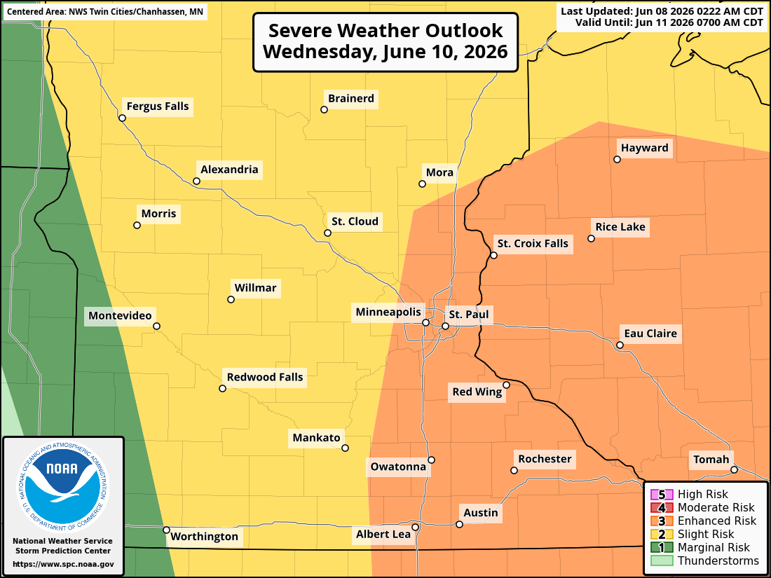
Severe Storm Threat and Hot Conditions Possible Across Minnesota and Wisconsin Tuesday and Wednesday
Hot conditions and multiple rounds of severe thunderstorms are expected across Minnesota and western Wisconsin on Tuesday and Wednesday. Large hail, damaging winds, tornadoes, and heavy rain are all possible, with the Twin Cities under an Enhanced Risk for severe weather on Wednesday.
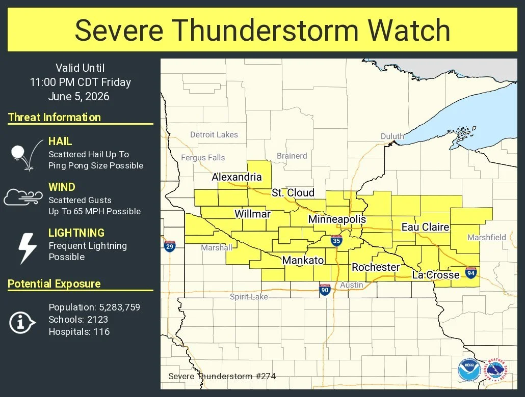
Severe Thunderstorm Watch Issued for Much of Central and Southern Minnesota, Western Wisconsin Until 11 P.M.
A Severe Thunderstorm Watch has been issued for portions of central and southern Minnesota and western Wisconsin and remains in effect until 11 p.m. CDT Friday, June 5, 2026, as conditions become favorable for the development of severe thunderstorms across the region.
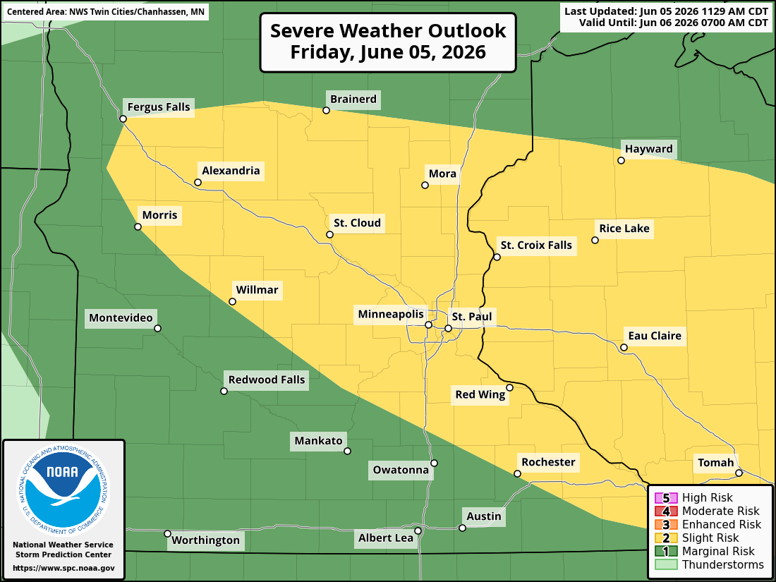
Twin Cities Area Upgraded to Slight Risk for Severe Weather Today; Large Hail and Damaging Winds Possible
The Twin Cities and much of central Minnesota are under a Slight Risk for severe thunderstorms on Friday, June 5, 2026. Large hail, damaging winds, and multiple rounds of storms are possible today.
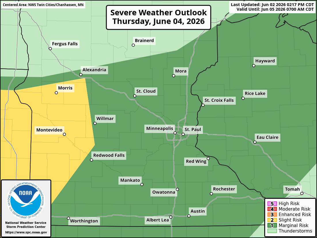
Twin Cities Area Could See Severe Thunderstorms, Large Hail, Damaging Winds, and Heavy Rain Thursday
The Twin Cities metro and much of Minnesota could experience strong-to-severe thunderstorms on Thursday, June 4, 2026, as a weather system moving across the Northern Plains creates conditions favorable for large hail, damaging winds, heavy rainfall, and localized flooding.
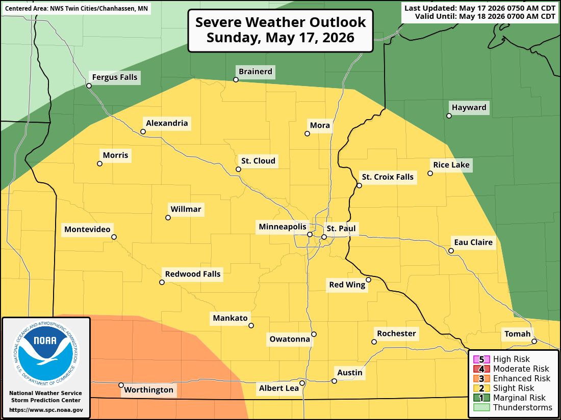
Severe Storms, Large Hail, Damaging Winds, and Heavy Rain Possible Across Parts of Minnesota Tonight
Here is the latest weather update for this evening, as strong-to-severe thunderstorms are expected Sunday evening into the overnight as an active weather pattern moves into the Upper Midwest.
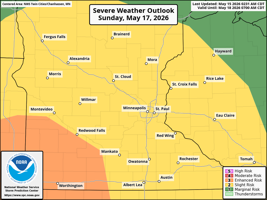
Severe Storm Threat Could Impact Twin Cities, Southern Minnesota Sunday Night
A potentially active weather pattern is expected to develop across the Upper Midwest this weekend, with the potential for severe thunderstorms Sunday evening and overnight across much of Minnesota and western Wisconsin, including the Twin Cities metro, as a few disturbances are forecast to work through the region.
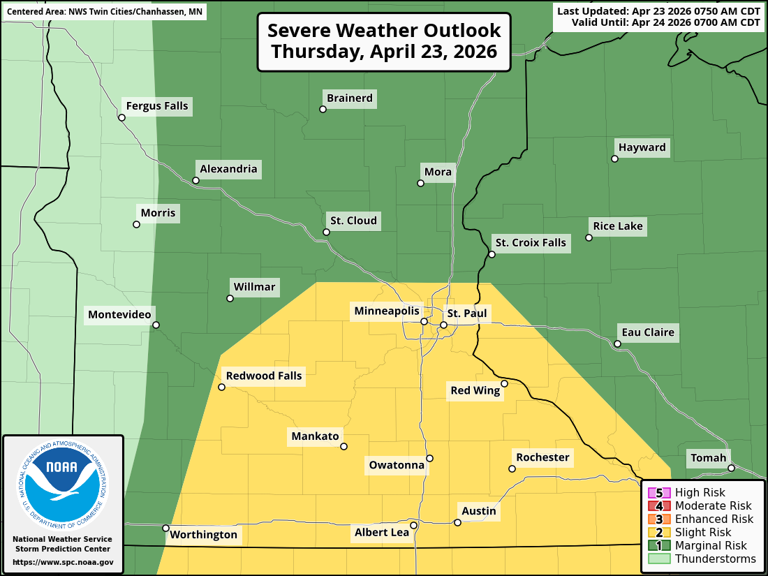
Severe Storms Expected Across Southern Minnesota, Twin Cities, and Into Western Wisconsin This Afternoon and Evening
Widespread thunderstorms are expected to develop across southern Minnesota and far western Wisconsin later today, with the potential for severe weather including damaging winds, large hail, and a low-end tornado threat.
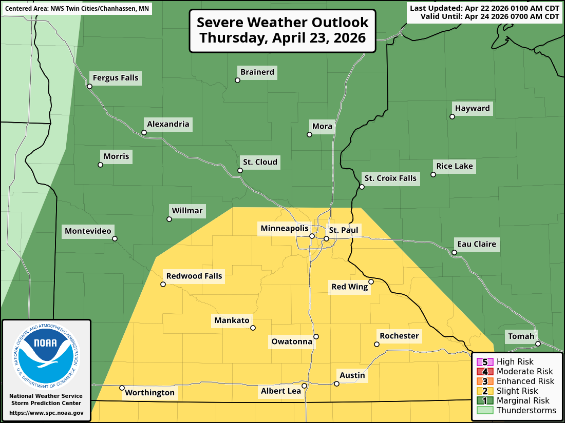
Severe Storm Threat Possible Across Twin Cities on Thursday
A round of potentially strong-to-severe thunderstorms will be possible as scattered showers and storms move across the Twin Cities and much of southern Minnesota on Thursday, bringing the threat of large hail, damaging winds, heavy rainfall, and even an isolated tornado.
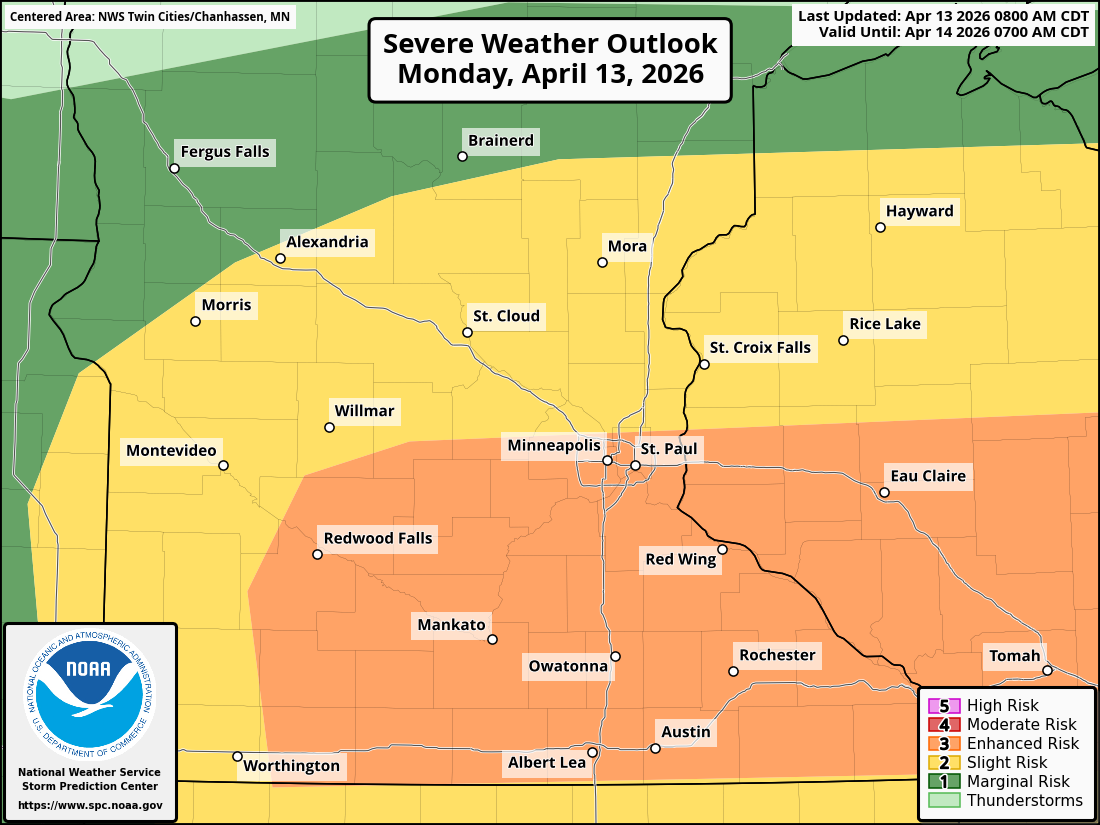
Enhanced Severe Weather Risk Monday Across Twin Cities; Large Hail, Damaging Winds, Isolated Tornado, and Flash Flooding Possible
The Storm Prediction Center has placed much of Minnesota, including the Twin Cities metro, under an Enhanced Risk (Level 3 of 5) for severe thunderstorms.

Storms Forecast to Return Across Minnesota this Week, Strong to Severe Storms Possible
After a brief period of mild weather across the Twin Cities, despite the smoke from Canada, we will see a shift this week to a hotter, humid, and stormier week ahead.