
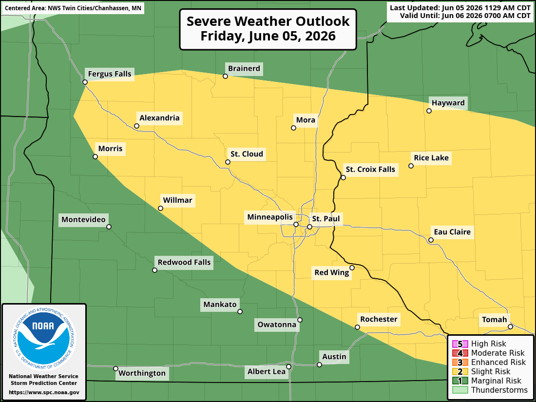
Twin Cities Area Upgraded to Slight Risk for Severe Weather Today; Large Hail and Damaging Winds Possible
Published: June 5, 2026
TWIN CITIES, MINNESOTA: There is an increasing potential for strong to severe thunderstorms this afternoon and evening, with the Storm Prediction Center (SPC) upgrading the area's severe weather threat from a Marginal Risk (Level 1 of 5) to a Slight Risk (Level 2 of 5).
Temperatures are forecast to climb into the low to mid-80s this afternoon, helping fuel thunderstorm development as a cold front moves across the Upper Midwest today. The greatest zone for potential storm development is across central Minnesota into west-central Wisconsin, though storms could impact portions of the Twin Cities metropolitan area as they move east through the evening hours. The greatest threat period for the Twin Cities metro looks to be around and after 5-6 PM, lasting until about 7-8 PM.
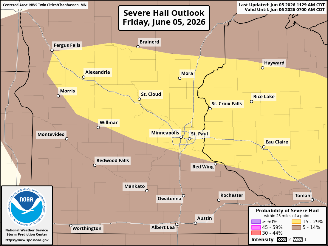
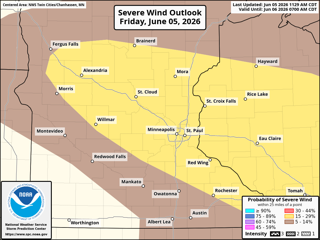
Large Hail and Damaging Winds Primary Concerns
Atmospheric conditions are expected to become increasingly favorable for strong-to-severe thunderstorms during the afternoon and evening, with the latest model guidance indicating 1,000 to 2,500 J/kg of instability (CAPE) combined with 30 to 35 knots of deep-layer wind shear, supporting the development of a few supercell thunderstorms.
The primary threats include:
Large hail
Damaging straight-line winds
Frequent lightning
Heavy rainfall
Any tornado threat remains very low..
SPC Upgrades Threat Level
The Storm Prediction Center upgraded portions of Minnesota and western Wisconsin to a Slight Risk late this morning, citing the potential for multiple rounds of thunderstorms and an increased likelihood of severe hail and damaging wind reports. A cold front stretching across the Upper Midwest and an area of low pressure moving along that boundary are expected to provide the focus for thunderstorm development throughout the day.
Initially, storms may develop as isolated cells capable of producing large hail. As the evening progresses, those storms are expected to organize into clusters and short line segments (bow echoes), increasing the potential for damaging wind gusts.
Storms Expected to Move Out Tonight
Thunderstorms are expected to move eastward through the evening before gradually exiting the region later tonight. Be weather aware throughout the afternoon and evening, especially if they have outdoor plans. Those attending community events, sporting activities, or traveling across the region should have multiple ways to receive weather warnings.
The National Weather Service may issue additional watches or warnings as conditions evolve throughout the day.
The greatest severe weather threat currently appears to be from late afternoon into the evening hours, with large hail and damaging winds posing the most significant risks.