
Severe Storms Expected Across Southern Minnesota, Twin Cities, and Into Western Wisconsin This Afternoon and Evening
Published: April 23, 2026
TWIN CITIES, MINNESOTA: Widespread thunderstorms are expected to develop across southern Minnesota and far western Wisconsin later today, with the potential for severe weather including damaging winds, large hail, and a low-end tornado threat.
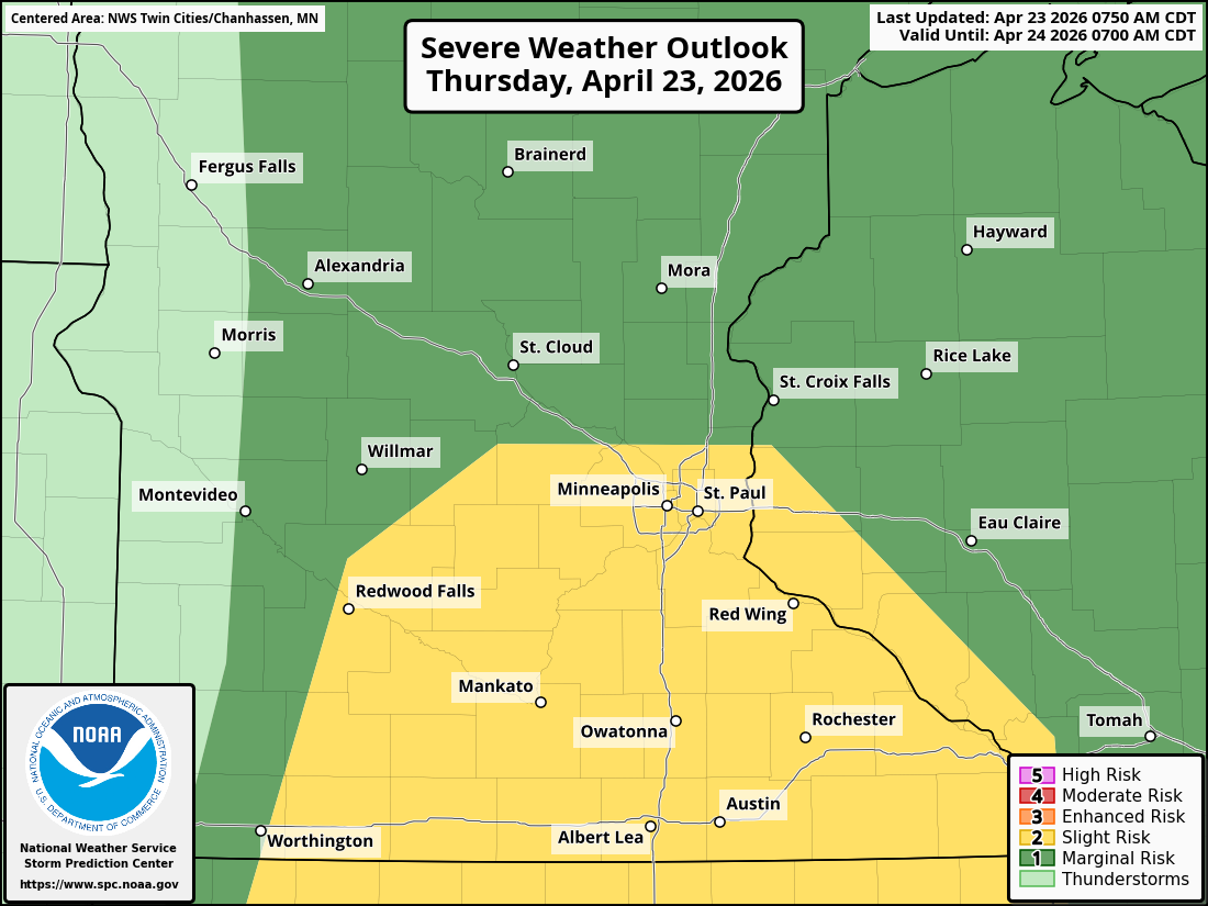
The Storm Prediction Center has placed much of southern Minnesota, the Twin Cities metro, and western Wisconsin under a Slight Risk (Level 2 out of 5) for severe weather. Areas outside of this zone remain under a Marginal Risk (Level 1 out of 5).
The primary threats with today’s storms include:
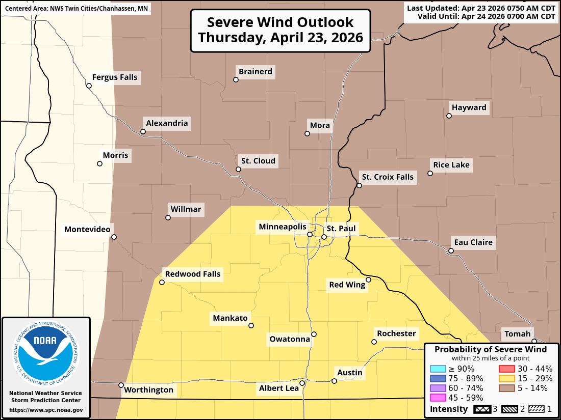
Damaging wind gusts exceeding 60 mph
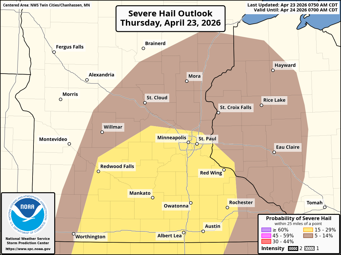
Large hail, potentially significant with early storms
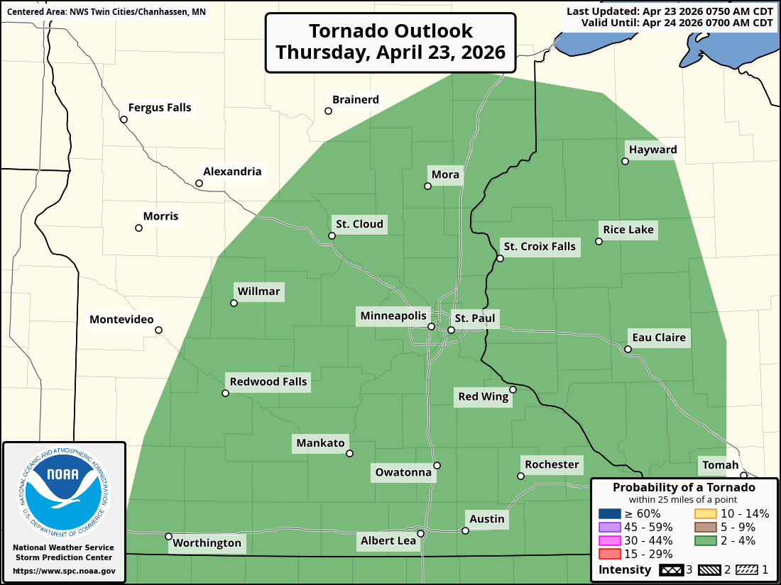
Isolated tornadoes, particularly during initial storm development
Timeline
Storms are expected to develop in stages as a strong weather system moves through the region.
Late Morning to Early Afternoon (12–3 p.m.): Initial storms develop across central and southern Minnesota
Mid to Late Afternoon (3–6 p.m.): Storms move east toward the I-35 corridor, including the Twin Cities
Evening (6–10 p.m.): Storms push into western Wisconsin
Early storms may remain somewhat isolated, but are expected to quickly grow into larger clusters or lines as they move east.
What’s Driving the Storms
A deepening area of low pressure near the North Dakota–Manitoba border is fueling today’s severe weather setup. This system is helping to push a cold front eastward into Minnesota, providing the necessary lift for storm development.
Early storms could form as discrete supercells, capable of producing large hail and a brief tornado. As the atmosphere evolves, storms are expected to organize into linear segments, increasing the risk for widespread damaging winds.
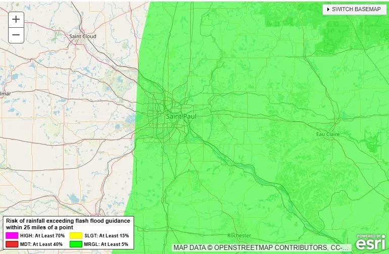
Heavy Rainfall Possible
In addition to severe weather, heavy rainfall is expected—especially east of the I-35 corridor into western Wisconsin.
Most areas may see 0.25 to 0.5 inches of rain
Parts of western Wisconsin could receive 0.5 to 1 inch or more
Isolated areas could exceed 1+ inch totals, particularly in stronger storms
The Weather Prediction Center has placed far eastern Minnesota and western Wisconsin under a Marginal Risk for excessive rainfall, meaning localized flooding cannot be ruled out.
Fire Weather Concerns in Western Minnesota
While storms dominate the forecast further east, parts of western Minnesota are dealing with a different hazard.
A Red Flag Warning has been issued for areas west of a line from Douglas to Redwood counties, where:
Relative humidity could drop into the teens
Winds will be breezy out of the southwest
Dry conditions create a high risk for rapid fire spread
These conditions mean any fires that start could spread quickly and become difficult to control.
What to Watch For
Residents across southern Minnesota, the Twin Cities, and western Wisconsin should remain weather-aware this afternoon and evening. Conditions may change quickly as storms develop and intensify.
Key things to monitor:
Rapidly developing thunderstorms during the afternoon
Severe weather warnings, especially for wind and hail
Sudden changes in visibility and road conditions during heavy rain
Possible isolated tornado warnings
Having multiple ways to receive warnings, such as weather alerts on your phone or a NOAA Weather Radio, is strongly recommended.