
Severe Thunderstorm Watch Issued for Much of Minnesota Through 8 PM
Published: April 23, 2026
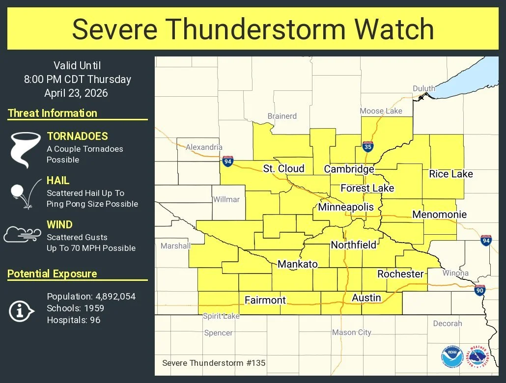
TWIN CITIES, MINNESOTA: The Storm Prediction Center has issued a Severe Thunderstorm Watch, in effect until 8:00 p.m. CDT Thursday, April 23, 2026, covering a large portion of southern and eastern Minnesota, including the entire Twin Cities metro.
Primary Threats
Storms developing this afternoon and evening could bring:
Damaging wind gusts up to 70 mph
Large hail up to 1.5 inches in diameter
An isolated tornado or two possible
Storm Timing & Development
Storms are expected to develop and intensify mid-to-late afternoon, especially across southern and central Minnesota. They will then move eastward into western Wisconsin later this evening while becoming more widespread and organized as the evening progresses.
This setup increases the risk for clusters or lines of storms capable of producing widespread wind damage, along with pockets of large hail and a limited tornado threat.
A Severe Thunderstorm Watch means conditions are favorable for severe weather. It does not mean severe weather is already happening, but it could develop quickly.
What You Should Do Now
Stay weather-aware and monitor updates from the National Weather Service
Have a way to receive warnings (phone alerts, NOAA Weather Radio, apps)
Be ready to move indoors quickly if storms approach
Secure loose outdoor items that could be blown around
Additional Reading: Severe Storms Expected Across Southern Minnesota, Twin Cities, and Into Western Wisconsin This Afternoon and Evening