
Severe Storm Threat and Hot Conditions Possible Across Minnesota and Wisconsin Tuesday and Wednesday
Published: June 8, 2026
TWIN CITIES, MINNESOTA: Severe weather is possible across Minnesota and western Wisconsin this week, including hot conditions, large hail, damaging winds, heavy rainfall, and the potential for tornadoes from Tuesday evening through Wednesday night.
Multiple rounds of thunderstorms that could impact the Twin Cities metro and much of the Upper Midwest as a weather system moves across the region.
Tuesday: Heat Builds Before Evening Storms
Tuesday is expected to be the warmest day of the week across much of Minnesota and western Wisconsin, with high temperatures forecast to climb into the lower 90s, while humidity will push apparent temperatures into the mid-to-upper 90s. While widespread heat advisory criteria may not be reached, conditions will still be uncomfortable and potentially dangerous for those spending extended time outdoors.
The warm, unstable atmosphere will set the stage for severe thunderstorm development Tuesday evening and overnight.
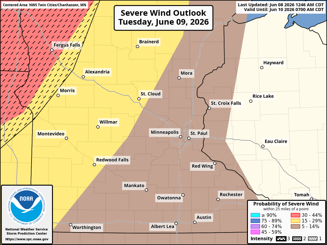
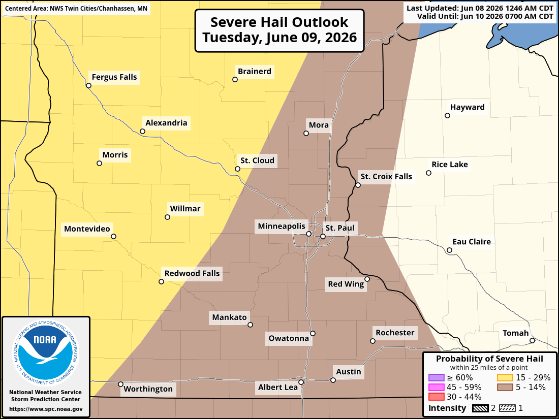
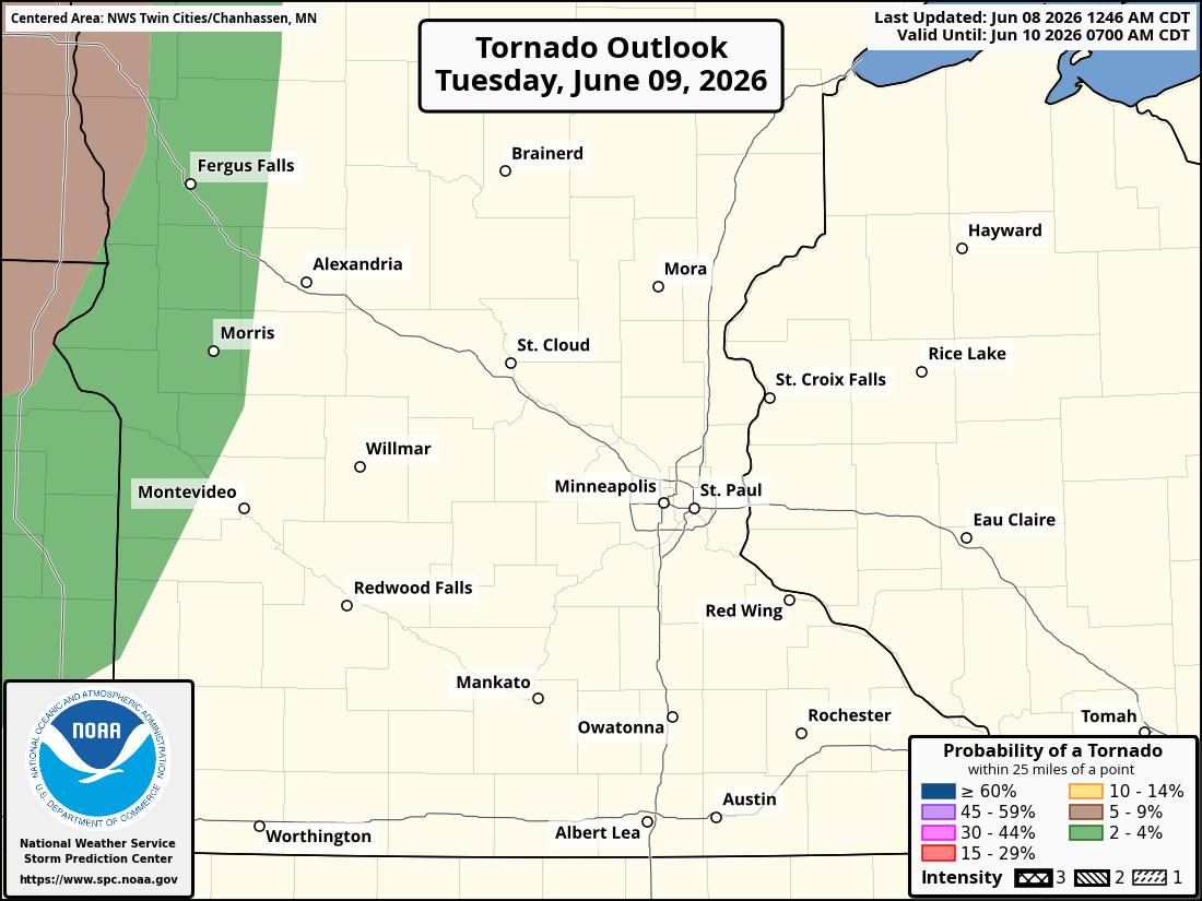
A strengthening low-level jet stream, exceeding 50 mph, is expected to shift into Minnesota Tuesday night. This surge of warm, moist air is expected to fuel a band of thunderstorms that will develop across southwestern Minnesota before lifting northeast through the Twin Cities metro and into northern Wisconsin by Wednesday morning. Any storms that develop Tuesday night could produce large hail, damaging wind gusts, torrential rainfall, and frequent lightning.
There is also potential for one or more mesoscale convective systems (MCSs), which are large complexes of thunderstorms capable of producing widespread damaging winds over long distances. Euro, GFS, and the NAM Nest models suggest a broken line of storms could pass through the Twin Cities Metro between 11 PM Tuesday and 3 AM Wednesday, after storms develop in southwestern Minnesota and track into the region.
The HRRR model, though, suggests a later development of this activity across southwestern Minnesota, with a possible broken line of storms moving into the region between 3 and 6 AM on Wednesday. This is something we will continue to monitor and will provide updates on later today and tomorrow.
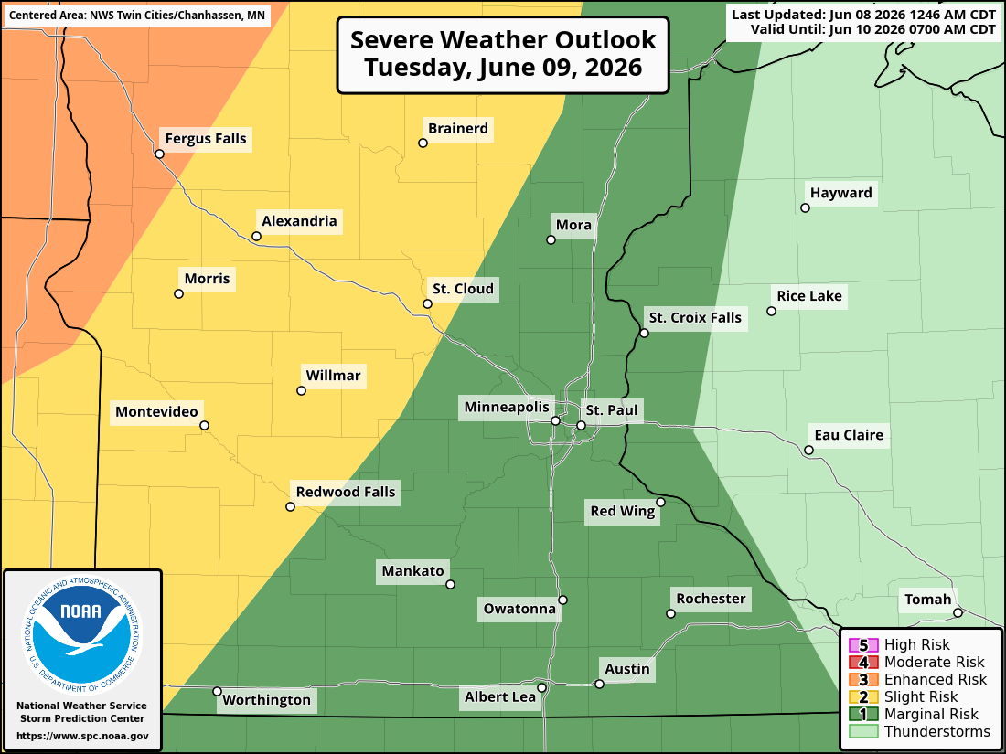
The Storm Prediction Center (SPC) is currently maintaining a Slight Risk (Level 2 of 5) for severe weather across portions of western Minnesota on Tuesday and a Marginal Risk (Level 1 of 5) across the Twin Cities Metro.
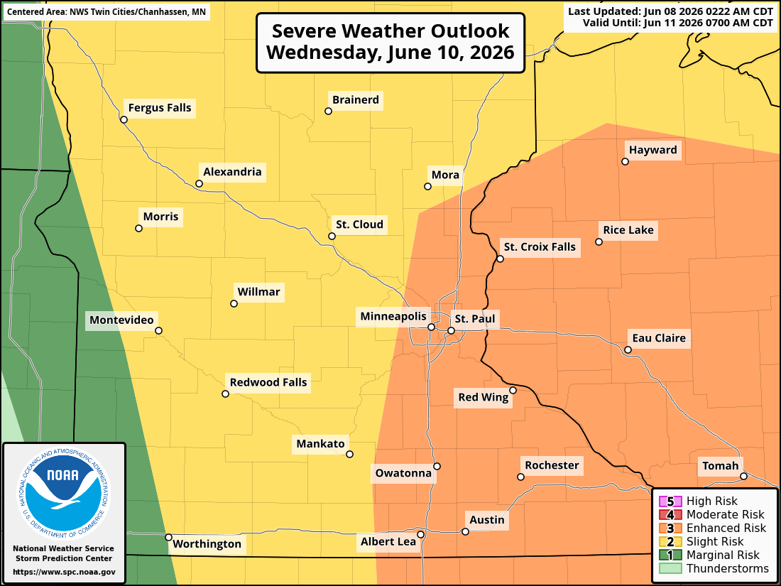
Wednesday: Enhanced Risk for Severe Storms Across the Twin Cities
The greatest concern for the Twin Cities and much of eastern Minnesota arrives Wednesday as an approaching cold front will interact with a very warm and humid air mass already in place across the Upper Midwest. Temperatures are expected to reach the upper 80s to lower 90s, while dew points climb into the lower and middle 70s. This combination will create a highly unstable atmosphere conducive to the development of intense thunderstorms.
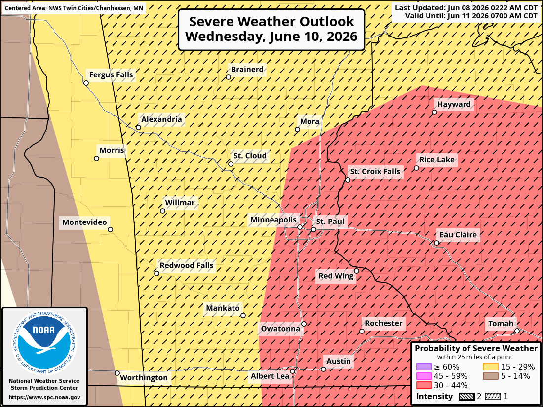
The SPC has placed much of eastern Minnesota and western Wisconsin under an Enhanced Risk (Level 3 of 5) for severe thunderstorms on Wednesday, signaling increasing confidence in widespread severe weather.
All severe weather hazards will be possible, including:
Damaging straight-line winds
Large to very large hail
Tornadoes
Heavy rainfall and localized flooding
Thunderstorms are expected to develop along and ahead of the advancing cold front Wednesday afternoon. Early storms could become supercells capable of producing large hail and tornadoes before quickly organizing into a larger squall line or MCS capable of widespread wind damage.
Current forecast guidance suggests storms may initially develop just west of the Twin Cities metro before moving eastward into Wisconsin. However, the exact timing and location of storm development remain uncertain and could shift over the next 24 to 48 hours.
Flash Flooding and Excessive Rainfall Threat Also Increasing
In addition to the severe weather threat, there is the potential for heavy rainfall and localized flash flooding across portions of Minnesota and Wisconsin through Wednesday.
The Weather Prediction Center (WPC) has highlighted parts of the Upper Midwest for excessive rainfall concerns over the next several days as multiple rounds of thunderstorms move through the region.
Flooding Risk Begins Today
A broad Marginal Risk (Level 1 of 4) for excessive rainfall extends across portions of the Upper Midwest today. While thunderstorms are expected to remain relatively progressive, meaning they continue moving rather than repeatedly tracking over the same locations, isolated flash flooding remains possible.
The greatest concern today will be in urban areas, where storm drains can quickly become overwhelmed by intense rainfall. The majority of this threat will be north and northwest of the Twin Cities metro today.
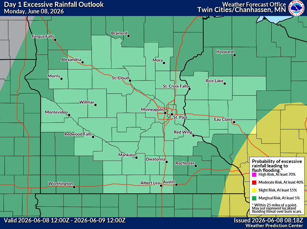
Monday (today) excessive rain/flash flooding threat.
Tuesday Night Storm Complex Could Produce Torrential Rain
The flash flood threat is expected to increase Tuesday afternoon and especially Tuesday night as severe thunderstorms develop across the Northern Plains and move eastward toward Minnesota.
The highly unstable atmosphere will support supercell thunderstorms before storms merge into a larger thunderstorm complex, or MCS, Tuesday evening and overnight. These storms will have access to abundant atmospheric moisture, with precipitable water values forecast between 1.5 and 2 inches, well above normal for early June. As a result, thunderstorms can produce extremely heavy rainfall, with rates potentially exceeding 2 inches per hour in the strongest storms.
Although the storm complex is expected to move steadily, reducing the risk of widespread flooding, localized flash flooding could develop where the heaviest rainfall occurs, particularly in:
Urban and suburban areas
Low-lying roadways
Areas with poor drainage
Locations that receive repeated rounds of thunderstorms
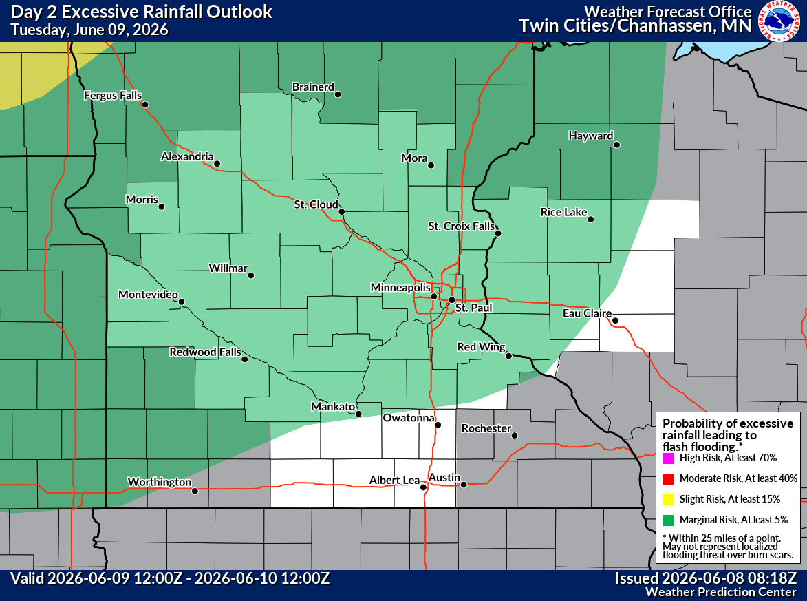
Tuesday excessive rain/flash flooding threat.
Wednesday Could Bring Additional Heavy Rainfall
The flood threat may continue into Wednesday as another round of storms develops ahead of a powerful cold front moving through the Upper Midwest.
Forecast models show impressive moisture transport into Minnesota and Wisconsin Wednesday morning, followed by another surge of moisture Wednesday evening as a strong low-level jet strengthens across the region.
Current guidance suggests some locations could receive 2 to 4 inches of rain, with locally higher amounts possible where thunderstorms repeatedly track over the same areas.
The Twin Cities metro, eastern Minnesota, and western Wisconsin could all see periods of heavy rainfall Wednesday, though the exact placement of the heaviest rain remains uncertain. It appears that rainfall totals projected by some models may underestimate potential amounts, as accurately forecasting thunderstorm-driven rainfall is difficult.
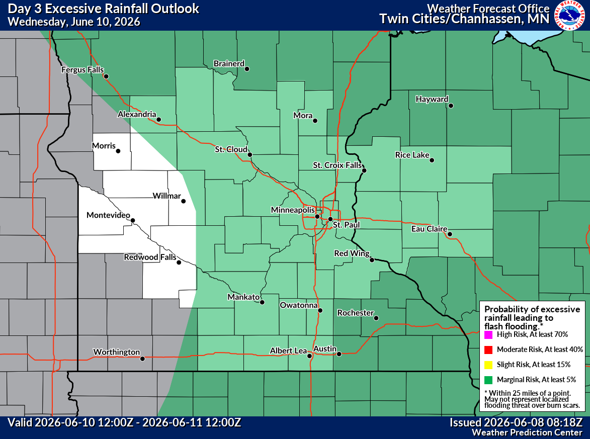
Wednesday excessive rain/flash flooding threat.
Twin Cities Residents Should Stay Alert
While severe weather hazards such as large hail, damaging winds, and tornadoes will likely receive the most attention, flash flooding can become just as dangerous.
Residents are encouraged to monitor forecasts closely and never drive through flooded roadways. Just a few inches of moving water can sweep away vehicles, and many flash flood-related deaths occur when motorists attempt to drive through flooded areas.
With multiple rounds of thunderstorms expected between Tuesday evening and Wednesday night, both severe weather and localized flooding will be concerns across the Twin Cities metro and much of eastern Minnesota and western Wisconsin.
Cooler Weather Arrives Thursday
The active weather pattern is expected to end abruptly once the cold front passes Wednesday night, with much cooler and drier air moving into Minnesota and Wisconsin on Thursday and remaining in place into next weekend.
High temperatures are expected to return to the 70s and lower 80s, providing a welcome break from the heat and humidity after what is expected to be an active stretch of weather across the Upper Midwest.
Forecast details will continue to evolve over the coming days; confidence is increasing that portions of Minnesota and western Wisconsin will experience impactful severe weather from Tuesday through Wednesday.
Stay with Limitless Media News for continuing updates, forecast changes, watches, warnings, and real-time severe weather coverage throughout the week.