
Severe Weather Threat Targets Twin Cities and Southern Minnesota Through Wednesday; Strong Tornadoes, Large Hail, and Damaging Winds Possible
Published: June 9, 2026
TWIN CITIES, MINNESOTA: We continue to monitor the potential for multiple rounds of strong-to-severe thunderstorms over the next 48 hours, which could produce very large hail, damaging winds exceeding 75 mph, and even strong tornadoes. The most significant severe weather threat is expected to unfold Wednesday afternoon and evening, although a separate round of strong storms is also expected to move into Minnesota late Tuesday night (tonight).
The severe weather threat comes as temperatures surge into the low 90s today and Wednesday, creating a hot, humid, and highly unstable atmosphere favorable for dangerous thunderstorms.
Hot and Humid Conditions Ahead of Storms
Temperatures are forecast to climb into the upper 80s and lower 90s this afternoon across much of Minnesota. Combined with dew points in the mid-to-upper 60s, heat index values could approach the mid-to-upper 90s in portions of southern and western Minnesota.
If anyone is expected to be spending extended periods outdoors, they should stay hydrated, take frequent breaks, and seek shade whenever possible.
First Round of Severe Storms Expected Late Tonight
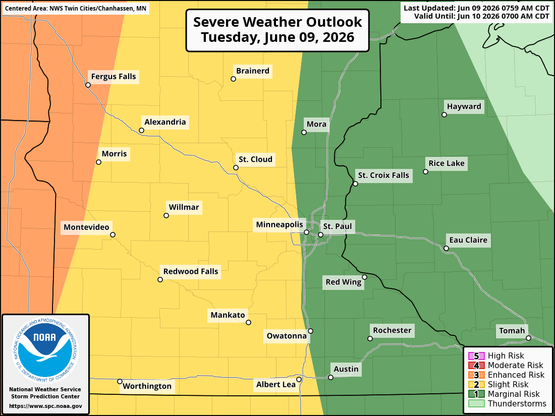
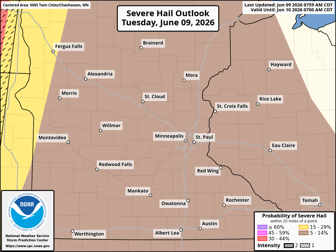
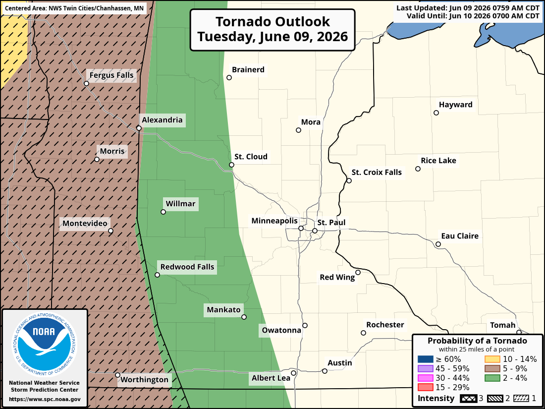
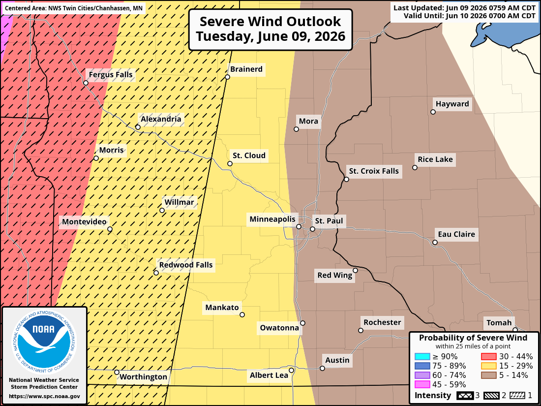
Thunderstorms are expected to develop across the Dakotas late this afternoon, then rapidly intensify and move east toward Minnesota overnight. As these storms enter western Minnesota around midnight, they are expected to organize into bowing segments and lines capable of producing:
Damaging straight-line winds
Large hail
Heavy rainfall
Isolated tornadoes
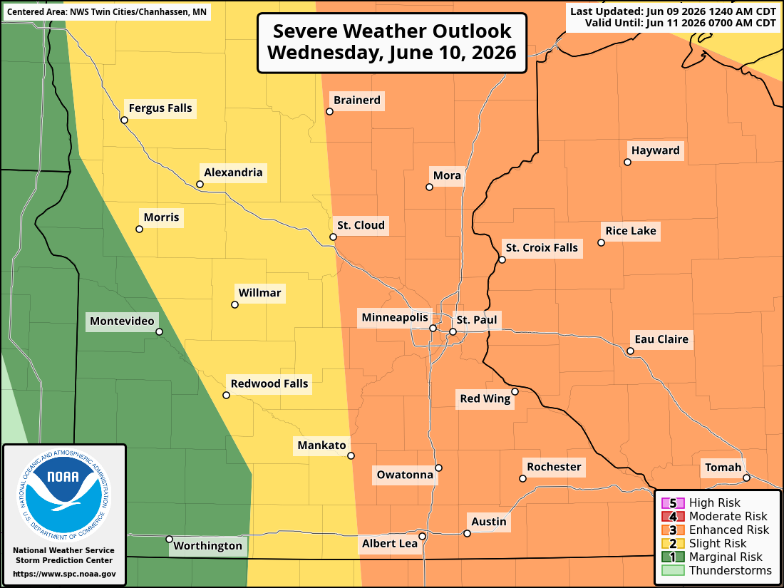
The Storm Prediction Center has placed parts of western Minnesota under an Enhanced Risk (Level 3 of 5) for severe weather tonight into early tomorrow morning. The western portions of the Twin Cities metro fall under a Slight Risk (Level 2 of 5), with the remainder of the metro under a Marginal Risk (Level a of 5). The primary threats early Wednesday morning in the Twin Cities would be damaging straight-line wind gusts, hail, and localized flash flooding.
While storms are expected to weaken as they move east across Minnesota overnight due to decreasing instability and loss of daytime heating, some strong storms may still reach the Twin Cities area around sunrise Wednesday. There remains some uncertainty about the arrival of these potentially strong storms into the Twin Cities, though, so be sure to check back for any additional updates.
In addition to severe weather, widespread rainfall is expected overnight, which could provide beneficial moisture but also contribute to localized flooding concerns in areas experiencing repeated rounds of storms. We dive into this deeper later in the article.
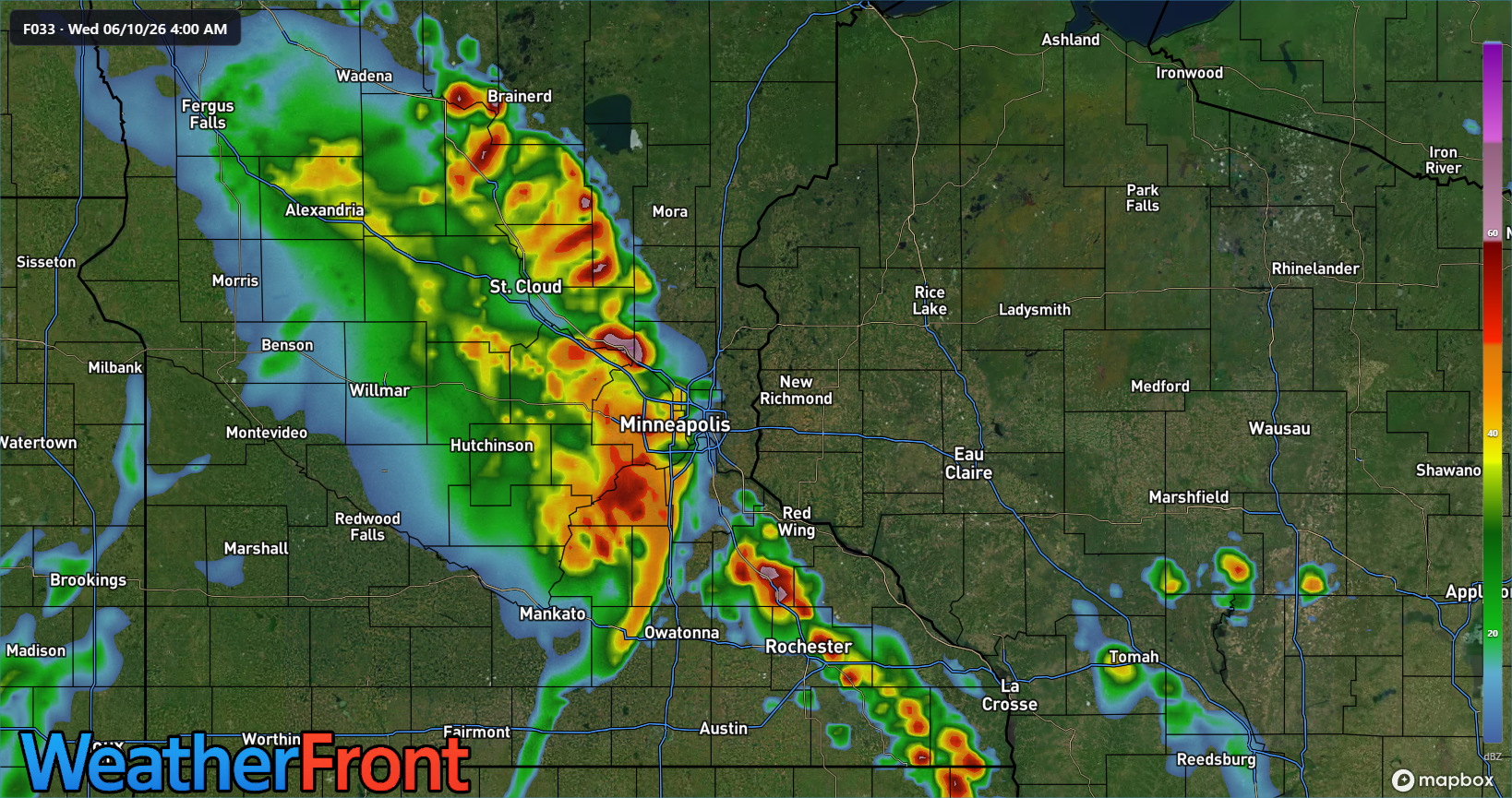
WeatherFront HRRR REFC F033 · Wed 06-10-26 4-00 AM
Wednesday Could Bring Greater Severe Concerns Weather
We continue to closely monitor Wednesday, which has the potential to become a significant severe weather day across eastern Minnesota and western Wisconsin. There remains uncertainty about how much cloud cover and leftover morning thunderstorms will persist during the day. If enough sunshine breaks through, atmospheric conditions could become highly favorable for explosive thunderstorm development.
Based on the latest model guidance, upwards of 2,000 to 4,000+ J/kg of instability (CAPE), with wind shear around 50 to 60 mph, will combine with dewpoints in the upper 60s to low 70s and support the development of discrete supercell thunderstorms capable of producing all modes of severe weather.
Strong Tornadoes Possible
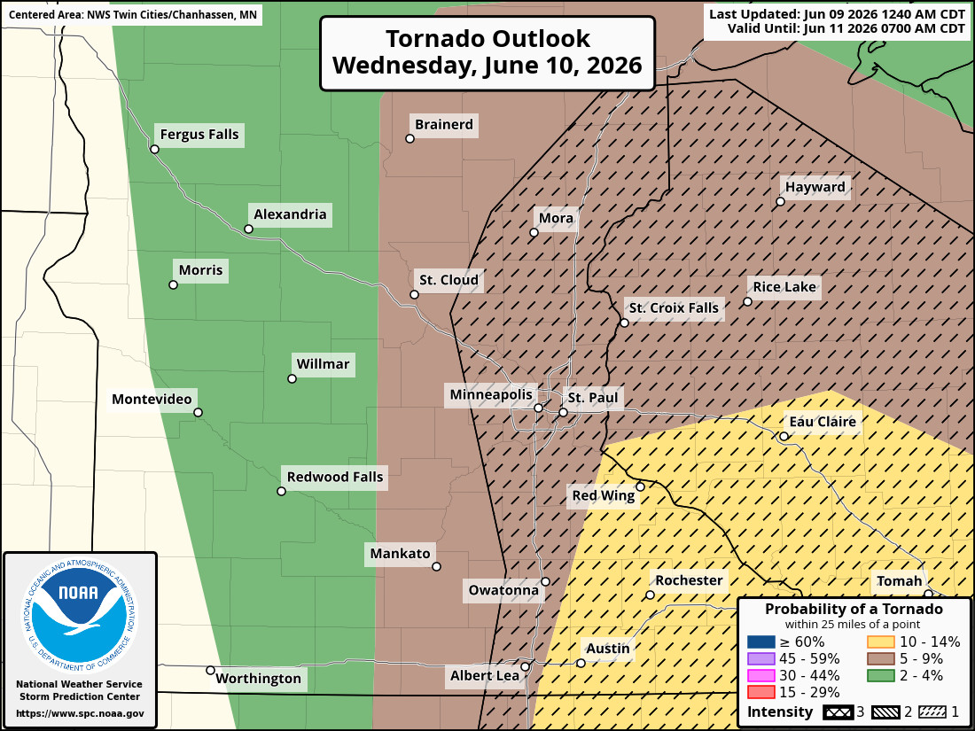
Of particular concern with these previously mentioned discrete supercell thunderstorms is the tornado threat on Wednesday afternoon and evening. Parts of eastern Minnesota and western Wisconsin may experience enhanced low-level wind shear, especially near any boundaries left behind by morning storms.
If supercells can remain isolated before storms merge into lines, conditions could support multiple tornadoes, large-to-very-large hail, and significant wind damage. A few strong tornadoes (EF2 or stronger) are possible across eastern Minnesota, Wisconsin, eastern Iowa, and northwestern Illinois if conditions align Wednesday afternoon.
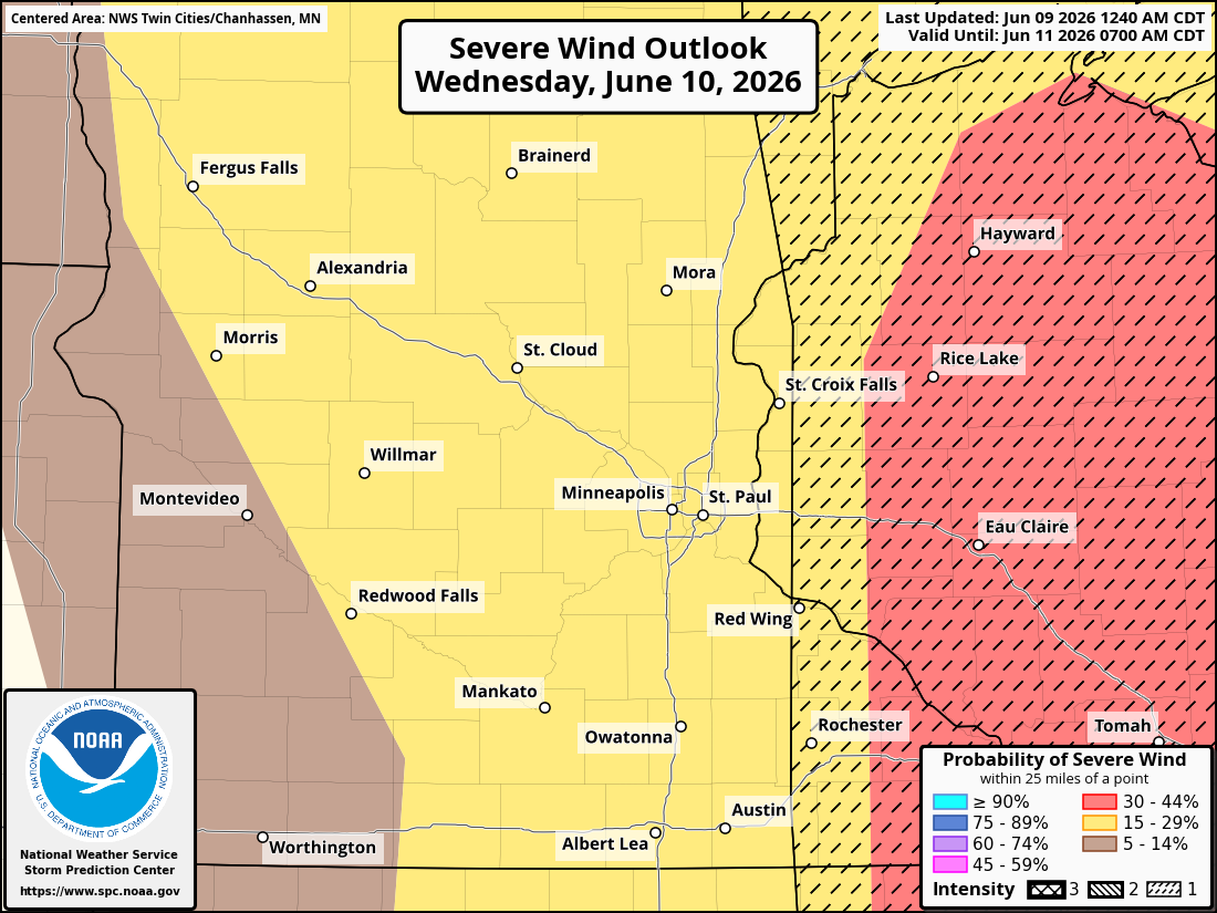
Areas from the Twin Cities eastward into western Wisconsin appear to be within the corridor where the strongest tornado threat could develop.
Very Large Hail and Destructive Winds Also Possible
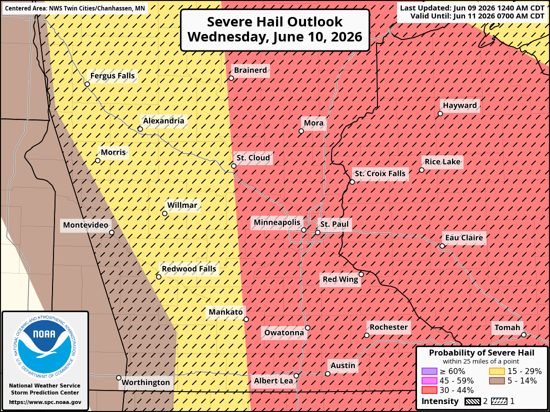
In addition to tornadoes, hail larger than 2 inches in diameter may accompany the strongest supercells Wednesday afternoon as storms mature and merge into larger clusters or lines during the evening; the threat is expected to transition toward widespread damaging winds. Wind gusts exceeding 75 mph may be possible within bowing segments as storms race eastward across Minnesota and Wisconsin.
Such winds are capable of downing trees and power lines, causing structural damage, and creating dangerous travel conditions. If you are planning on traveling tomorrow across eastern Minnesota into Wisconsin, please plan ahead and either leave earlier or delay your travel.
The Storm Prediction Center currently places much of eastern Minnesota, including the Twin Cities metropolitan area, under an Enhanced Risk (Level 3 of 5) for severe thunderstorms on Wednesday.
Flash Flooding and Excessive Rainfall Threat Update
In addition to the severe weather threat, there is also a potential for heavy rainfall and localized flash flooding across portions of Minnesota and Wisconsin through Wednesday.
The Weather Prediction Center notes that an intensifying low-level jet this evening will help thunderstorms organize into a larger mesoscale convective system (MCS) capable of producing very heavy rainfall. Some of the strongest storms may generate rainfall rates exceeding 2 inches per hour.
While the storms are expected to move relatively quickly, limiting the overall flood threat, rainfall could fall so quickly that it overwhelms drainage systems and causes flash flooding, particularly in urban areas and locations that receive repeated rounds of storms. A Slight Risk for excessive rainfall has been issued across portions of North Dakota and northwestern Minnesota tonight, while a broader Marginal Risk extends into parts of Minnesota (including the Twin Cities) and the Upper Midwest.
Flood Threat Continues Wednesday
The risk for heavy rainfall is expected to continue on Wednesday as a cold front pushes east across the Upper Midwest.
Showers and thunderstorms may already be ongoing Wednesday morning across northern Minnesota before another round of storms develops during the afternoon and evening. As previously mentioned, a very moist atmosphere ahead of the front, which is helping to support the severe weather threat, will have precipitable water values climbing to 1.5-2 inches, providing ample fuel for heavy downpours.
Although the highest flash flood risk is currently centered farther south across portions of Iowa and Missouri, the Weather Prediction Center maintains a broader Marginal Risk area extending northward into Minnesota and Wisconsin. The strong-to-severe thunderstorms developing along the cold front could produce rainfall rates exceeding 2 inches per hour, leading to isolated flash flooding where storms repeatedly track over the same areas.
Urban areas, low-lying locations, and places that received heavy rainfall from tonight's storms will be particularly vulnerable to flooding. Motorists are urged to never drive through flooded roadways and to remain alert for rapidly changing conditions during periods of heavy rain.
What Residents Should Do
With multiple rounds of thunderstorms expected over the next two days, emergency personnel encourage residents to monitor updated forecasts closely and have multiple ways to receive weather warnings.
Additionally, be sure to review severe weather safety plans before storms develop, identify a safe shelter location, especially if tornado warnings are issued, and charge electronic devices in advance in case of power outages.
Again, Wednesday's severe weather threat will depend heavily on how the atmosphere recovers after Tuesday night's storms. Additional forecast updates and possible watches or warnings are likely as confidence increases.
Looking Ahead
A cold front is expected to sweep through the region Wednesday night, bringing an end to the severe weather threat. Much cooler and more comfortable conditions are forecast to arrive Friday and continue through the weekend, with significantly lower chances for thunderstorms.
Stay weather-aware through Wednesday evening, as there is a potential for dangerous severe weather across the Twin Cities and surrounding areas.
Stay with Limitless Media News for additional forecast updates, watches, warnings, and real-time severe weather coverage.
