
Severe Thunderstorm Watch Issued for Twin Cities Area Until 8 PM Friday
Published: June 19, 2026
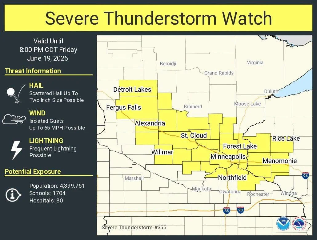
TWIN CITIES, MINNESOTA: A Severe Thunderstorm Watch has been issued for much of central and east-central Minnesota, including the Twin Cities metropolitan area, until 8:00 PM CDT Friday, June 19, 2026, as atmospheric conditions become favorable for the development of severe thunderstorms capable of producing large hail and damaging winds.
The watch includes the Twin Cities metro and surrounding communities, stretching from portions of west-central Minnesota through central Minnesota and into western Wisconsin.
Forecasters say the primary threats with any storms that develop this afternoon and evening will be:
Large hail up to 2 inches in diameter
Wind gusts up to 65 mph
Frequent cloud-to-ground lightning
There is a potential for significant hail, which could cause damage to vehicles, roofs, siding, and crops. Hail approaching two inches in diameter is roughly the size of a hen egg and is capable of breaking windows and causing substantial property damage.
Strong thunderstorm wind gusts could also bring down tree branches, cause scattered power outages, and make travel hazardous, especially for high-profile vehicles.
Storm Development Expected This Afternoon
The watch was issued as a warm, unstable air mass remains in place across much of Minnesota. As temperatures rise through the afternoon, thunderstorms are expected to develop and intensify. While not every community within the watch area will experience severe weather, any storms that do form could quickly become strong to severe.
Residents across the Twin Cities, including Minneapolis, St. Paul, and surrounding suburbs, are encouraged to remain weather-aware throughout the afternoon and evening. The general threat time for the Twin Cities metro is between 4 and 8 PM.
Watch vs. Warning
A Severe Thunderstorm Watch means conditions are favorable for severe thunderstorms to develop. It does not mean severe weather is occurring yet.
A Severe Thunderstorm Warning, however, is issued when severe weather is imminent or already occurring and requires immediate action.
Safety Tips
Residents should consider the following precautions:
Monitor weather alerts throughout the afternoon and evening.
Move vehicles into garages or under cover if possible to protect them from hail.
Secure outdoor furniture and loose objects that could become airborne in strong winds.
Have multiple ways to receive warnings, including weather apps, NOAA Weather Radio, and local media.
Move indoors immediately if thunder is heard, as lightning can strike miles away from a storm.
Limitless Media News will continue monitoring conditions and provide updates if warnings are issued or severe weather develops across the Twin Cities region.
Watch Expiration: 8:00 PM CDT Friday, June 19, 2026.