
Messy Spring Storm to Bring Snow, Sleet, and Freezing Rain Across Twin Cities Wednesday Night into Thursday, Winter Weather Advisory issued
Published: March 31, 2026.
TWIN CITIES, MINNESOTA: No, this is not an April Fools' Day prank. A messy spring storm is set to move across Minnesota and western Wisconsin beginning Wednesday afternoon, bringing a mix of rain, freezing rain, sleet, and snow to the region.
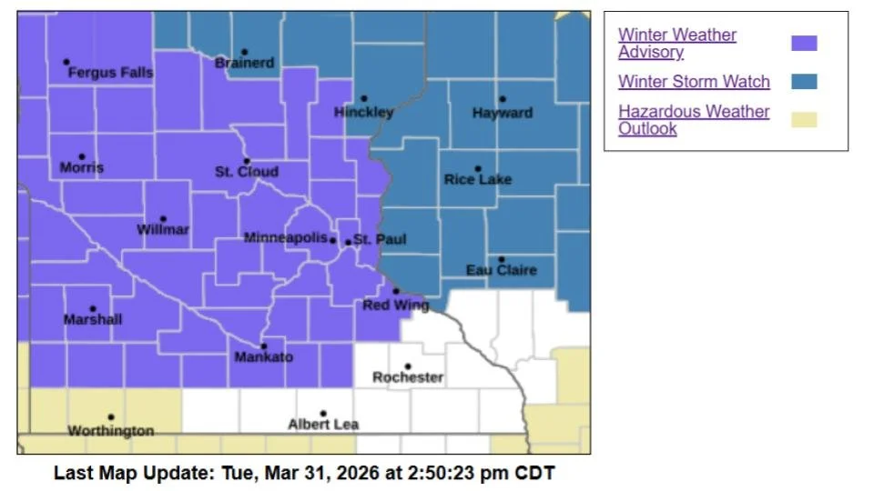
The National Weather Service Twin Cities has issued a Winter Weather Advisory for much of the Twin Cities metro and surrounding areas, in effect from 7 p.m. Wednesday through 7 p.m. Thursday.
What to Expect
This system will bring multiple types of precipitation, with conditions changing throughout the event:
Snow: Up to 3 inches possible, mainly north and west of the metro
Sleet: Around 1 inch possible, especially across central and southern Minnesota
Ice (freezing rain): Up to 0.10 inch, with localized higher amounts possible
Rain: May mix in at times, especially early in the event
The Twin Cities sit near a transition zone, meaning small shifts in the storm’s track could significantly impact what type of precipitation falls, and how much accumulates.
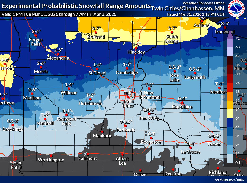
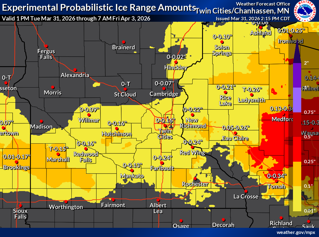
Accumulation maps provided by the NWS Twin Cities.
Timing Breakdown
Wednesday Afternoon: Precipitation begins in western Minnesota, initially as rain or light snow
Wednesday Evening: Expands into the Twin Cities, transitioning to snow north and a wintry mix south
Overnight Wednesday: Peak impacts, sleet and freezing rain likely across the metro
Thursday Morning: Slippery conditions expected for the commute
Thursday Afternoon/Evening: Precipitation tapers off
Travel Impacts Expected
Drivers should prepare for hazardous travel conditions, particularly during the Wednesday evening commute and Thursday morning commute.
Roads may become snow-covered or slushy, icy due to freezing rain, and slick from sleet accumulation.
Officials urge drivers to slow down, use caution, and check road conditions through Minnesota’s 511 system.
Forecast Uncertainty: Ice vs. Sleet
One of the biggest questions with this storm is how much freezing rain vs. sleet develops.
Current forecasts favor more sleet than freezing rain
However, if warmer air pushes farther north, ice accumulations could increase, leading to more significant impacts
The overnight hours pose the greatest risk for ice accumulation, as daytime warmth and April sun angle may limit icing during daylight.
Another Round of Wintry Weather This Weekend
This system will not be the only one impacting the region, as another storm is expected to have its sights on the Twin Cities late Friday into Saturday, with:
Potential for heavy snow (6+ inches) across central Minnesota and northern Wisconsin
Lower confidence in how far south the heavier snow band will reach
Twin Cities could see a mix, depending on the storm track
Key Takeaways
A messy mix of snow, sleet, and freezing rain is expected Wednesday night through Thursday
Travel impacts likely, especially during commutes
Ice amounts remain uncertain, but even light icing could create hazardous conditions
A second storm this weekend could bring additional snow to parts of Minnesota