
Fire Weather Watch Issued for Central, Southern Minnesota as Critical Conditions Expected Saturday
Published: March 26, 2026.
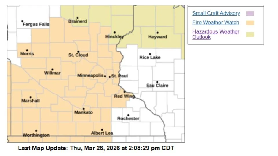
TWIN CITIES, MINNESOTA - Residents across central and southern Minnesota are being urged to use extreme caution this weekend as officials warn of potentially dangerous conditions that could lead to rapidly spreading wildfires.
The National Weather Service Twin Cities has issued a Fire Weather Watch in effect from Saturday afternoon through Saturday evening, citing a combination of weather factors that significantly increase the risk of fire ignition and spread. While the snow “just” melted for most places over the last week or so, fine/flashy fuels, like dead materials, dry grass, leaves, pine needles, or other materials around 1/4” diameter or less, can dry quickly under warm and dry conditions. They are often called 1-hour fuels because they can dry out in about an hour under the right conditions and ignite very easily.
Elevated Risk Factors
Several conditions are aligning to create what could become critical fire weather conditions, including:
Warm temperatures approaching 60 degrees
Very low relative humidity, dropping as low as 15–20 percent
Strong southwest winds sustained at 20 to 30 mph
Wind gusts reaching up to 40–45 mph
Dry vegetation (“fuels”) across the region
This combination creates an environment where even a small spark could quickly grow into a fast-moving fire.
Rapid Fire Spread Possible
Officials warn that any fires that develop could spread rapidly and become difficult to control, especially in open or rural areas where winds can accelerate fire movement.
Due to these risks, outdoor burning is strongly discouraged during the watch period. This includes:
Burning brush or yard waste
Campfires
Use of fire pits or burn barrels
Any activity that could produce sparks, such as equipment use
Authorities are also being advised to notify fire crews and local officials to remain alert and prepared for potential fire incidents.
Conditions Expected to Improve
Relief is expected relatively quickly after the peak risk window. According to the National Weather Service:
Saturday night into Sunday will bring increased low-level moisture
Winds will weaken, reducing fire spread potential
These changes should help improve conditions and lower the overall fire risk heading into the latter part of the weekend.
Public Safety Reminder
With Spring conditions often bringing a mix of dry vegetation and fluctuating weather patterns, fire officials emphasize that prevention is key.
Residents are encouraged to:
Avoid outdoor burning entirely during the watch
Properly dispose of cigarettes
Secure trailer chains to prevent sparks on roadways
Report any signs of smoke or fire immediately
The Fire Weather Watch serves as an early alert that conditions are favorable for dangerous fires. If conditions worsen or become imminent, it could be upgraded to a Red Flag Warning, indicating that critical fire weather is either occurring or expected shortly.
Officials will continue to monitor conditions and provide updates as needed.