
Memorial Day Weekend Forecast: Twin Cities

Published: May 23, 2026
TWIN CITIES, MINNESOTA: After a stretch of cooler and unsettled weather, Memorial Day weekend is shaping up to bring a gradual warm-up across the Twin Cities, with temperatures climbing from the 70s into the upper 80s by Memorial Day itself. While there will be a few opportunities for scattered showers, especially late Sunday into Monday, widespread washout conditions are not expected.
Saturday (Today)
Saturday will feature mostly cloudy skies at times as a slow-moving cold front pushes east across Minnesota. A few scattered light showers may develop, particularly across eastern portions of the Twin Cities metro and western Wisconsin. Most rainfall will be nuisance-type showers with limited impacts.
Temperatures will remain on the cooler side, generally in the 70s, with light winds gradually turning northwesterly behind the front.
What you need to know:
Mostly cloudy at times
Isolated to scattered light showers are possible
Best rain chances east of Interstate 35
Highs in the low to mid 70s
Sunday
Sunday marks the start of a noticeable warming trend as high pressure builds into the Upper Midwest. Sunshine should become more common through the day, and temperatures will rebound nicely into the lower 80s.
Most of the daytime hours look dry for outdoor plans, though a few scattered showers could begin developing later Sunday evening and overnight.
Just a note: if you’re going to be in southwestern Minnesota, there is currently a Marginal Risk (1/5) for severe weather, with isolated large hail and damaging winds as the main threats associated with the frontal passage.
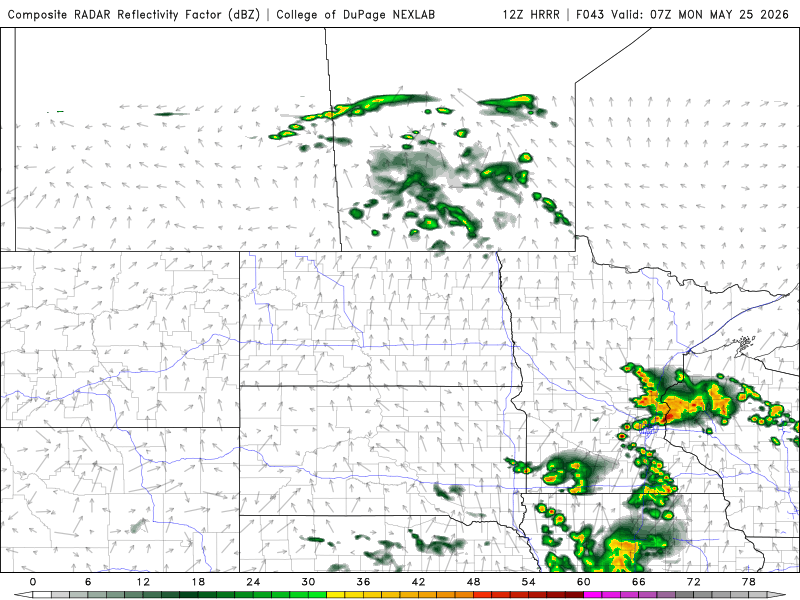
12z HRRR from Saturday, May 23 at 0700Z (2 AM, Monday, May 25th) showing the scattered shower and storm threat late Sunday into Monday morning.
What you need to know:
Warmer with increasing sunshine
Mainly dry during the day
Slight chance for showers late Sunday night
Highs near 80 to the lower 80s
Low-end severe threat in southwestern Minnesota
Memorial Day (Monday)
Memorial Day itself is expected to be warm and somewhat humid, with highs climbing into the mid to upper 80s across much of the metro area.
There remains a chance of scattered showers, especially during the morning, with mostly spotty precipitation. At this time, widespread severe weather is not expected, and many areas could remain dry for much of the day.
If you have outdoor ceremonies, cookouts, or travel plans, it's a good idea to keep an eye on the radar, but the day certainly does not look like a complete washout.
What you need to know:
Very warm for late May
Scattered showers possible
No widespread severe weather is expected at this time
Highs in the mid to upper 80s
Looking Ahead
The warming trend continues beyond the holiday, with temperatures potentially reaching the upper 80s to lower 90s by Tuesday as a blocking weather pattern develops across central North America. Rain chances also appear limited for much of next week after Memorial Day.