
Twin Cities Forecast: Wintry Mix Sunday, Milder Pattern to Follow
Published: January 3, 2026, at 1:20 pm.
TWIN CITIES, MINNESOTA: A period of wintry precipitation is expected Sunday, with freezing rain and sleet the primary concerns in the Twin Cities Metro. Impacts could be significant despite light amounts, especially during a 2–4 hour window on Sunday afternoon. Warmer, above-normal temperatures arrive early next week and persist through much of the first week of 2026.
Sunday: Brief but Potentially Impactful Wintry Mix
As a low-pressure system develops to the west of the region today, it will allow moisture to surge into the area late tonight through Sunday ahead of the system, thanks to a warm, southerly flow. As this warm, moist air works into the region early Sunday, it will set the stage for mixed precipitation.
By late morning to early afternoon on Sunday, precipitation is expected to develop across the Twin Cities, from west-northwest to east-southeast, across the Metro. While overall precipitation totals will be light, the type of precipitation is the primary concern.
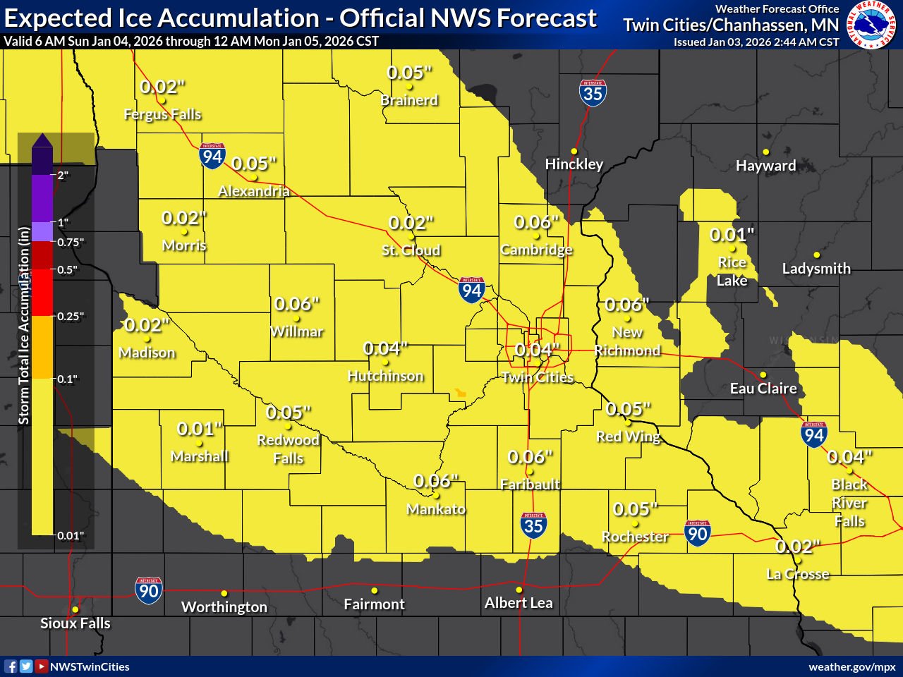
Primary precipitation type: Freezing rain and sleet
Timing: Likely late morning through mid-to-late afternoon (10-11 AM to 2-3 PM).
Duration: Possibly short-lived (2–4 hours)
Ice/sleet amounts: Generally a light glaze to a few hundredths of an inch
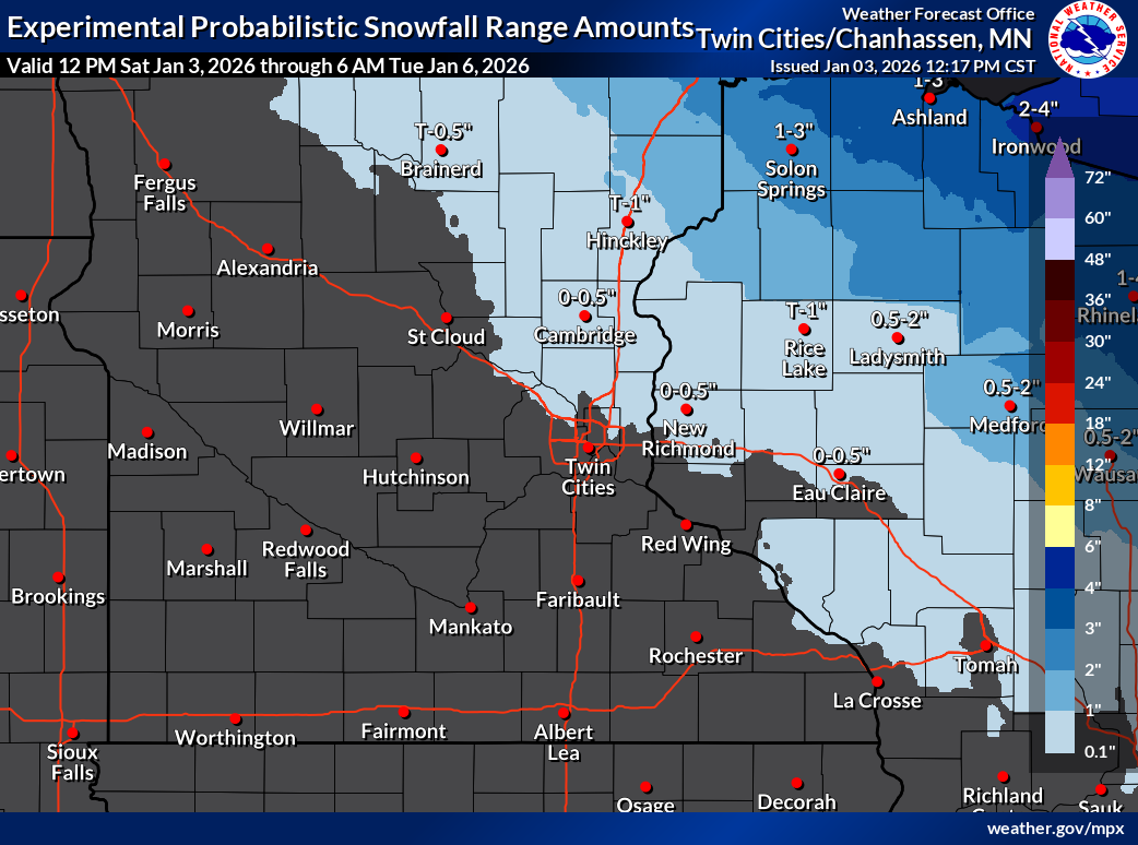
Snowfall amounts: Trace-0.50 inches, mainly along the I-94 corridor and points north into western Wisconsin.
Surface temperatures on Sunday will hover near or just below freezing, which means even small amounts of ice could make roads, sidewalks, and untreated surfaces slick. Snow is expected to remain limited to areas east and north of the Twin Cities, mainly in western Wisconsin, with little to no accumulation in the metro area.
Travel Impacts
Despite light precipitation totals, freezing rain is an efficient hazard, and even a thin glaze can significantly impact travel. The highest concern window appears to be Sunday afternoon, especially for elevated roadways, bridges, and untreated surfaces.
Early Week: Turning Milder
As the system exits by early Monday, a noticeable warm-up follows for next week:
Highs climb above freezing by Tuesday.
Above-normal temperatures are expected through much of the week.
A few weak disturbances may pass through this week, bringing low chances for light precipitation, but no major systems are currently indicated through midweek.
Looking Ahead: Late-Week into Next Weekend
Attention shifts to the end of this week and into next weekend, when a deeper trough may move into the Plains and potentially bring the chances for a strong area of low pressure working into the region. If the ingredients do come together, this could bring the next opportunity for more widespread precipitation and a return of more seasonable winter temperatures.
Residents across the Twin Cities Metro should stay weather-aware on Sunday, particularly in the afternoon, and be prepared for rapidly changing road conditions. Limitless Media will continue to monitor the latest updates. We will pass along any weather advisories issued by the National Weather Service Twin Cities.
Forecast graphics provided by the NWS Twin Cities.