
Dangerous Arctic Blast Brings Extreme Cold to the Twin Cities Through Saturday
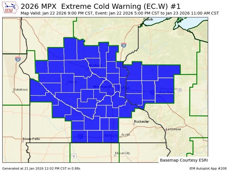
Extreme Cold Warning is in effect until 11 am Friday morning.
Published: January 21, 2026, at 7 am.
TWIN CITIES, MINNESOTA: A dangerous Arctic air mass is settling over the Twin Cities, bringing the coldest conditions of the season so far and prompting an Extreme Cold Warning and Extreme Cold Watch for much of Minnesota, including the metro area. Officials warn that life-threatening wind chills could cause frostbite in minutes and urge residents to take precautions through at least Saturday morning.
According to the National Weather Service - Twin Cities, an Extreme Cold Warning is in effect from 9 p.m. Thursday through 11 a.m. Friday, followed by an Extreme Cold Watch from Friday morning through Saturday morning as the frigid air lingers.
What to Expect: Bitter Cold and Dangerous Wind Chills
Northwest winds tonight will usher in the coldest air mass the region has experienced this winter, and potentially the coldest since the late-January 2019 cold snap, according to the NWS Twin Cities. Temperatures will peak around midnight and then steadily fall through Thursday and Friday.
Thursday:
Temperatures start the day in the single digits above zero, falling to near or below -10°F by late afternoon. Wind chills will rapidly worsen, reaching -15°F to -25°F across the Twin Cities by mid-afternoon, with even colder readings to the north and west.Thursday Night into Friday Morning:
Conditions deteriorate significantly. Actual air temperatures are expected to bottom out in the mid-teens to mid-20s below zero, while wind chills are expected to plunge to -40°F or colder. These values meet criteria for extreme cold, where frostbite can occur on exposed skin in as little as 10 minutes.Friday:
High temperatures struggle to reach the single digits or teens below zero before falling again Friday night. Winds should gradually ease as high pressure moves overhead, meaning wind chills may become closer to the actual air temperature, still dangerously cold, but potentially “less” severe than Friday morning.Friday Night into Saturday Morning:
Temperatures dip back into the 20s below zero. With lighter winds, forecasters are watching closely to determine if wind chills remain extreme. This uncertainty is why the Extreme Cold Watch remains in effect, though at a minimum, a Cold Weather Advisory is expected to be issued by the NWS Twin Cities.
How Long Will the Cold Last?
Saturday and Sunday remain well below normal, but a slow moderation is expected. Highs should begin edging upward, and by early next week, temperatures may return to more typical winter values with highs in the mid to upper teens above zero. Even so, long-range models suggest another potential cold snap late next week, signaling that winter’s grip is far from over as January ends and February begins.
Safety and Preparedness Reminders
Officials stress that these conditions are dangerous and potentially life-threatening:
Dress in multiple layers, including a hat, face covering, and insulated gloves
Limit time outdoors and take frequent warm-up breaks if you must be outside
Keep pets indoors as much as possible
Check on neighbors, especially the elderly or those without reliable heat
Ensure vehicles have emergency winter supplies if travel is unavoidable
Residents across the Twin Cities are urged to take this cold seriously and plan accordingly as the region endures one of the harshest cold spells in years.
Forecast graphics provided by the NWS Twin Cities.