
Winter Weather Advisory Issued for Twin Cities and Southern Minnesota as Snow, High Winds Move In
Winter Weather Advisory issued through 9 PM Wednesday.
Published: February 18, 2026.
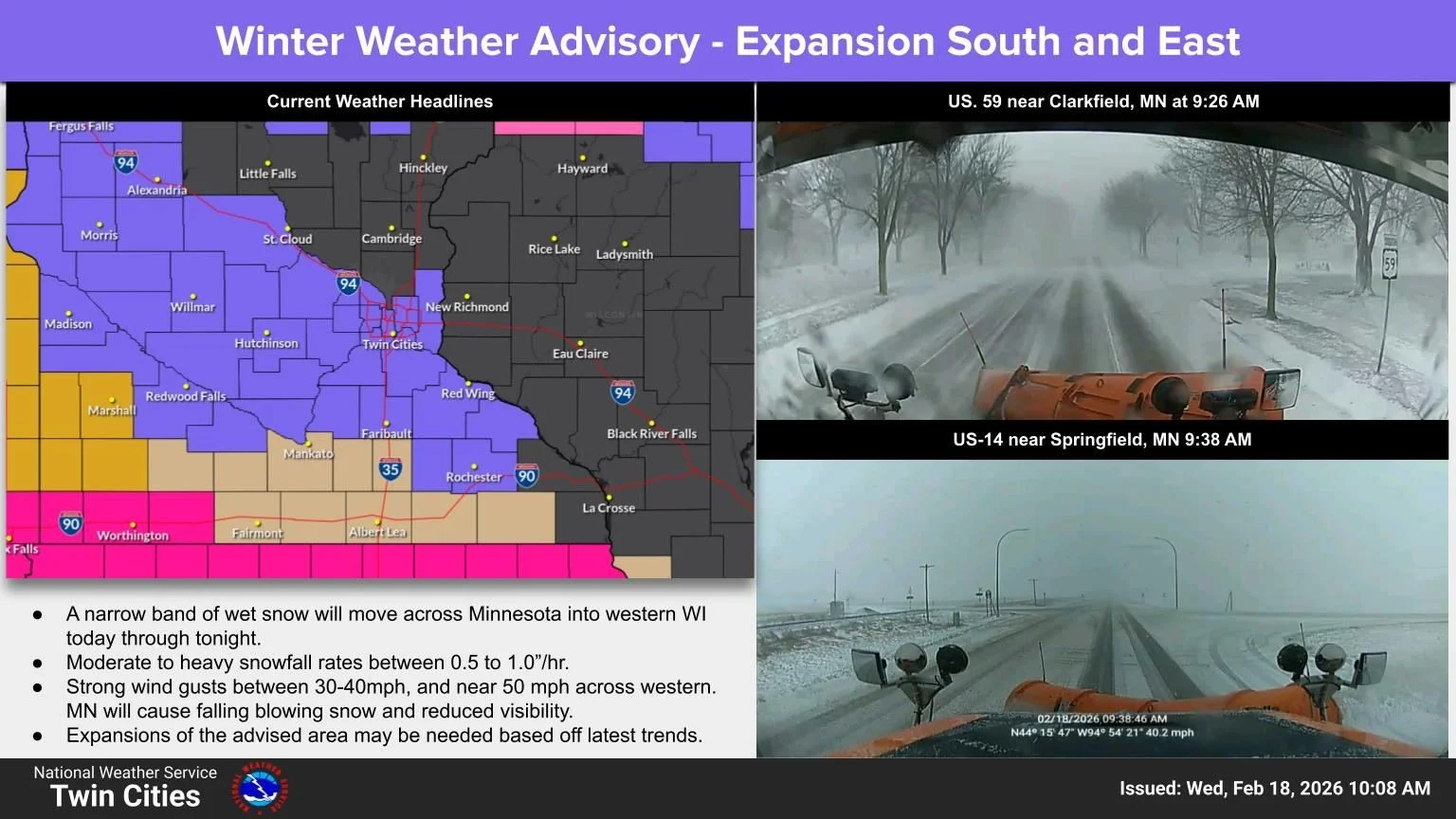
TWIN CITIES, MINNESOTA: A Winter Weather Advisory remains in effect through 9 p.m. Wednesday for much of southern and central Minnesota, as rain transitions to accumulating snow and strong winds create hazardous travel conditions across the region.
The advisory was updated late Wednesday morning to include Goodhue County, expanding the area impacted by the developing winter system.
Snow Developing, Heavier Band Possible
Rain began transitioning to snow early Wednesday across a significant portion of southern Minnesota, including areas along and south of the Minnesota River and into the western suburbs of the Twin Cities metro. As temperatures continue to fall throughout the day, forecasters expect precipitation to change entirely to snow.
A narrow but potentially heavier band of snow is forecast to move from west-central Minnesota southeast toward the Twin Cities and into far western Wisconsin during the afternoon and evening hours. The band is expected to track roughly from Morris to the Twin Cities metro.
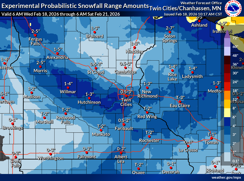
Total snow accumulations of 2 to 4 inches are expected across the advisory area. While much of the Twin Cities metro may see 1 to 2 inches, recent high-resolution forecast trends suggest that heavier amounts could extend farther east into the metro if the narrow band shifts slightly.
Strong Winds Up to 50 MPH
In addition to snowfall, strong winds will accompany the system, with gusts between 45 and 50 mph possible. While the snow is expected to be wet and heavy, limiting blowing snow once it accumulates, falling snow combined with strong winds will significantly reduce visibility at times.
Gusty winds may also bring down tree branches, especially where wet snow accumulates on limbs.
Slippery Roads, Commute Impacts Expected
Road conditions are expected to deteriorate quickly as slushy snow develops and temperatures drop. Officials warn that hazardous conditions will impact both the Wednesday morning and evening commutes.
Drivers are urged to slow down, allow extra travel time, and use caution while traveling. Road condition updates are available by calling 511 or visiting 511mn.org.
Areas Included in the Advisory
The Winter Weather Advisory covers the following counties:
Wright
Hennepin
Ramsey
Washington
McLeod
Sibley
Carver
Scott
Dakota
Nicollet
Le Sueur
Rice
Goodhue
Cities included in the advisory area include Minneapolis, St. Paul, Shakopee, Hastings, Chaska, Victoria, Chanhassen, Hutchinson, Gaylord, St. Peter, Le Sueur, Monticello, Stillwater, and Faribault.
Additional Snow Chances Late Week
Looking ahead, colder temperatures are expected to settle in late this week. Another system may bring accumulating snow Thursday night into Friday, primarily affecting southeastern Minnesota and western Wisconsin.
Residents are encouraged to monitor updated forecasts throughout the day, as small shifts in the storm track could lead to higher snowfall totals locally.
Further updates will be provided as conditions evolve.
Forecast graphics provided by the NWS Twin Cities.