Winter Weather Advisory Issued: 2–4 Inches of Snow Expected Saturday, Localized 6”+ Band Possible
Published: February 27, 2026 | Updated: February 27, 2026 at 1:15 PM.
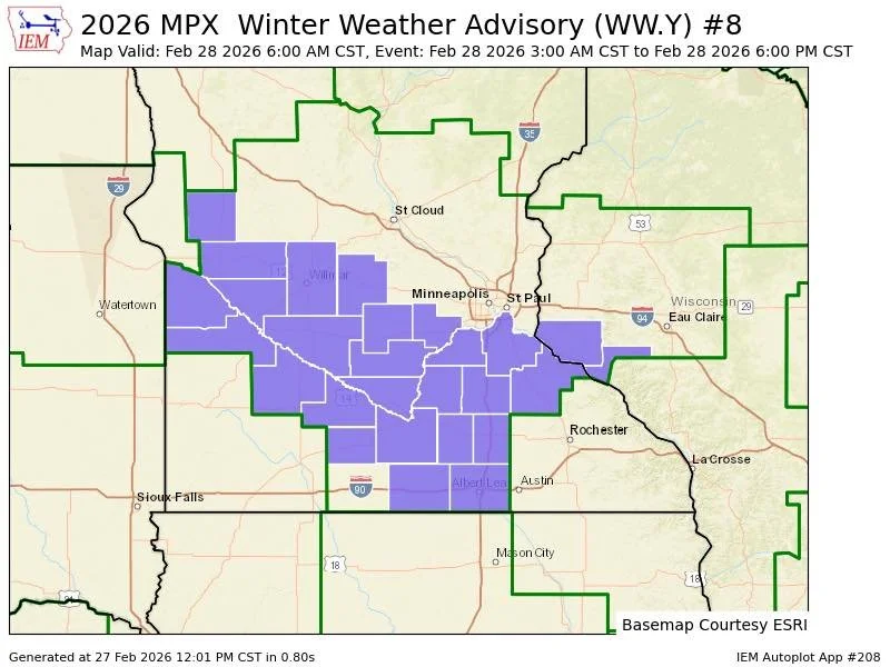
TWIN CITIES, MINNESOTA: The forecast for Saturday’s snow has been updated, and the National Weather Service Twin Cities has issued a Winter Weather Advisory from 6 a.m. to 6 p.m. CST Saturday from the southern Twin Cities Metro to southern Minnesota and into portions of western Wisconsin.
A quick-hitting band of heavy snow will move across the region early Saturday morning through the afternoon, bringing more widespread impacts than initially anticipated.
Updated Snow Totals
Snowfall totals are now expected to range between 2 to 4 inches across the advisory area. However, a narrow band of significantly higher amounts, potentially 6 inches or more, is likely to set up somewhere within the advisory region.
As with many banded snow events, exact placement remains critical. Communities under the heaviest band could see totals double those just a few miles away.
Counties included in the advisory:
Minnesota:
Carver
Scott
Dakota
Rice
Goodhue
Watonwan
Faribault
Wisconsin:
Pierce
Pepin
Timing
5-6 AM Saturday: Snow begins spreading into the region.
Late Morning–Afternoon: Heaviest snowfall rates develop.
By Saturday Evening: Snow gradually ends from west to east.
Drivers traveling during the advisory window should be prepared for changing conditions, especially where heavier bursts develop.
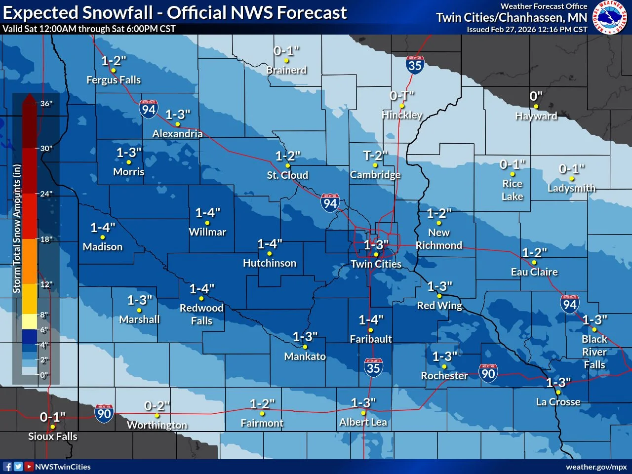
Provided by the NWS Twin Cities and is as of 12:16 pm. Forecast totals are subject to change.
Travel Impacts Possible
Public works departments have begun pre-treating roadways, as we’ve seen brine applications on area roadways across the City of Apple Valley. With that being said, if the heavier band tracks through the south metro, we expect roads could become snow-covered quickly, especially during periods of higher snowfall rates. While this does not appear to be a major winter storm, even 1–3 inches falling steadily can create slick travel conditions. Winds thankfully don’t look to be took much of an issue in this event, with gusts early on up to around 20 mph at times, but are forecast to decrease through the day.
Motorists are encouraged to:
Slow down and increase following distance
Allow extra travel time
Monitor road conditions before heading out
For real-time road updates: