
Potent Winter Storm Could Bring Heavy Snow, Strong Winds, and Possible Blizzard Conditions to Minnesota and Western Wisconsin
Published: December 27, 2025.
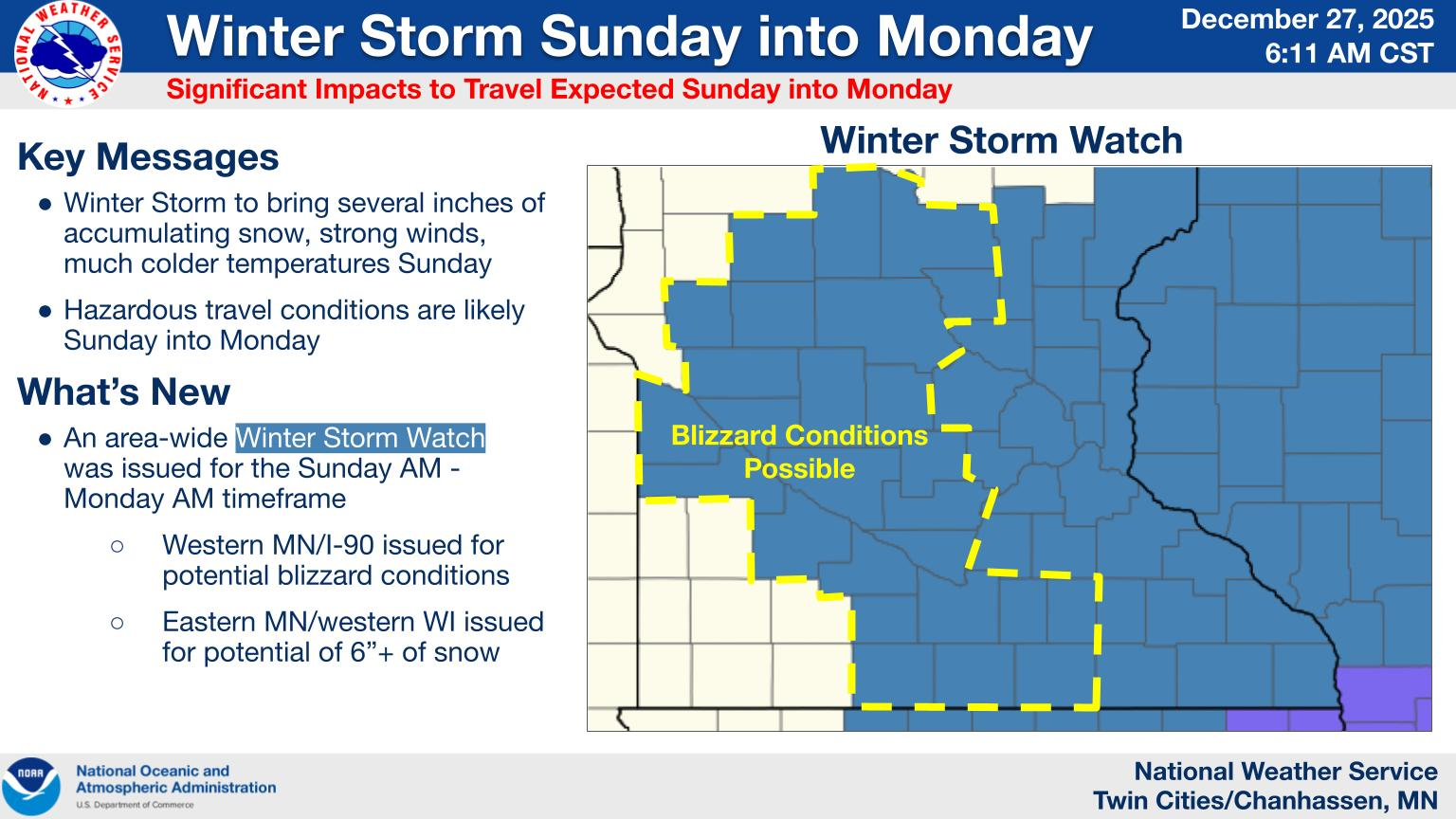
TWIN CITIES, MINNESOTA: A strengthening winter storm is expected to impact much of central and southern Minnesota, extending into western Wisconsin, from Sunday morning through early Monday, bringing accumulating snow, strong winds, and the potential for blizzard-like conditions, according to the National Weather Service.
Storm Timeline and Evolution
The winter system is developing over the Northern Plains and is forecast to intensify rapidly as it moves into the Upper Midwest on Sunday. Snow is expected to begin across western and southern Minnesota Sunday morning, while eastern Minnesota and western Wisconsin may initially see rain. As colder air moves in during the day, that rain is expected to transition to all snow.
By Sunday afternoon and evening, snowfall is expected to become moderate to heavy at times, particularly across eastern Minnesota and western Wisconsin.
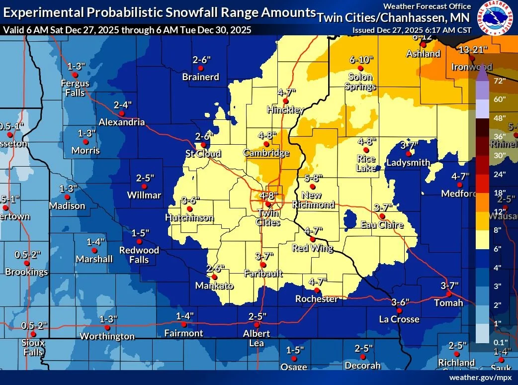
Snowfall Totals and Ice Potential
Forecasts currently call for 5 to 8 inches of snow, with some localized areas potentially seeing higher amounts. In addition, a light glaze of ice is possible during the rain-to-snow transition, which could further complicate travel.
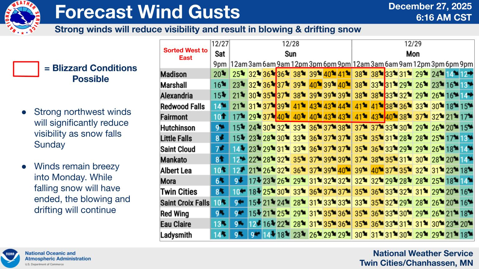
Strong Winds and Blizzard Risk
As snowfall continues Sunday evening into Sunday night, strong winds are expected to develop, with gusts up to 40 mph. These winds, combined with falling and blowing snow, may significantly reduce visibility.
The most significant risk for blizzard conditions is expected across western and far southern Minnesota, where near-whiteout conditions could occur for prolonged periods.
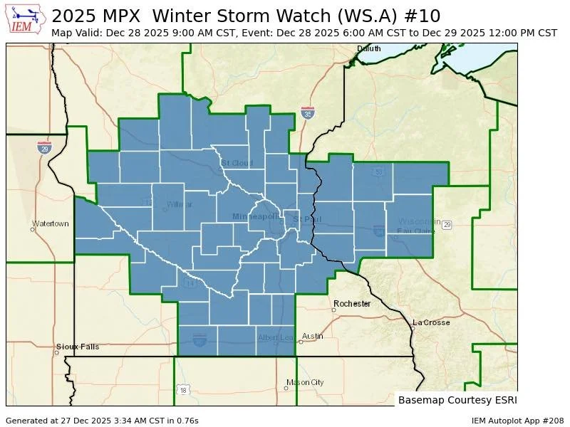
Areas Under a Winter Storm Watch
A Winter Storm Watch is in effect from Sunday morning through Monday morning for portions of:
Central Minnesota
East-central Minnesota
South-central Minnesota
Southeast Minnesota
This includes counties such as Hennepin, Ramsey, Dakota, Washington, Anoka, Wright, Scott, Carver, Rice, Goodhue, and surrounding areas. Cities potentially impacted include Minneapolis, St. Paul, Blaine, Stillwater, Hastings, Red Wing, Shakopee, Chaska, Chanhassen, Faribault, and Cambridge, among others.
Travel Impacts
Officials warn that travel may become very difficult from Sunday through Sunday night due to:
Heavy snowfall at times
Blowing and drifting snow
Reduced visibility from strong winds
Hazardous conditions could carry into the Monday morning commute, especially if snow and blowing snow persist overnight.
What Residents Should Do
Residents are urged to:
Monitor updated forecasts and alerts through the weekend
Prepare for possible travel disruptions or delays
Consider altering or postponing travel plans if conditions worsen
Ensure vehicles and emergency kits are winter-ready
These details may change as the storm approaches, and encourage everyone to stay informed as watches may be upgraded to warnings.
This is a developing weather situation. Updates will be provided as new information becomes available.