
UPDATED: Winter Storm Warning Issued for Twin Cities and Southern Minnesota; Up to 18 Inches of Snow Possible
UPDATE - MARCH 14, 2026, at 3 PM: Blizzard Warning Issued for Twin Cities Metro as Historic March Winter Storm Moves In
Published: March 13, 2026 | Last Update: March 14th at 7:20 am
TWIN CITIES, MINNESOTA: A powerful winter storm is expected to bring significant snowfall, strong winds, and dangerous travel conditions across the Twin Cities metro and much of southern Minnesota beginning Saturday evening and continuing into Monday morning.
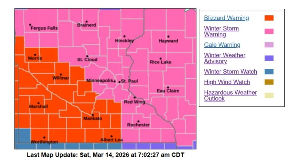
The National Weather Service in the Twin Cities has upgraded the region to a Winter Storm Warning, warning that travel could become very difficult or even impossible late Saturday night through Sunday as heavy snow and strong winds combine to create near-blizzard conditions. Just to the west of the Twin Cities, the NWS has issued Blizzard Warnings for wind gusts of 45-50 mph, which will cause blowing and drifting snow and reduced visibility on Sunday into Monday.
The Winter Storm Warning is in effect from 4 p.m. Saturday, March 14, through 4 a.m. Monday, March 16.
Heavy Snowfall Expected Across the Region
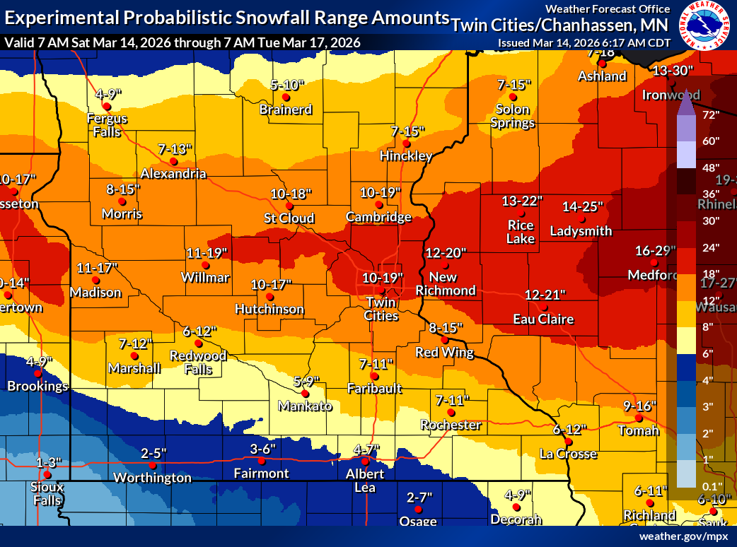
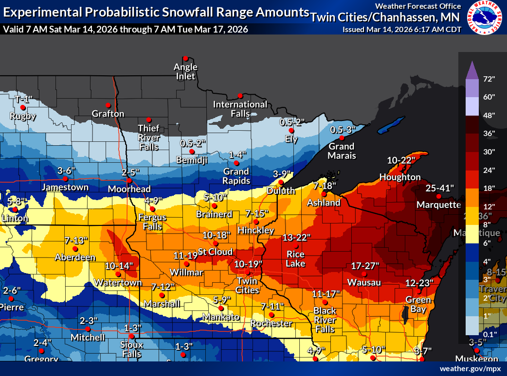
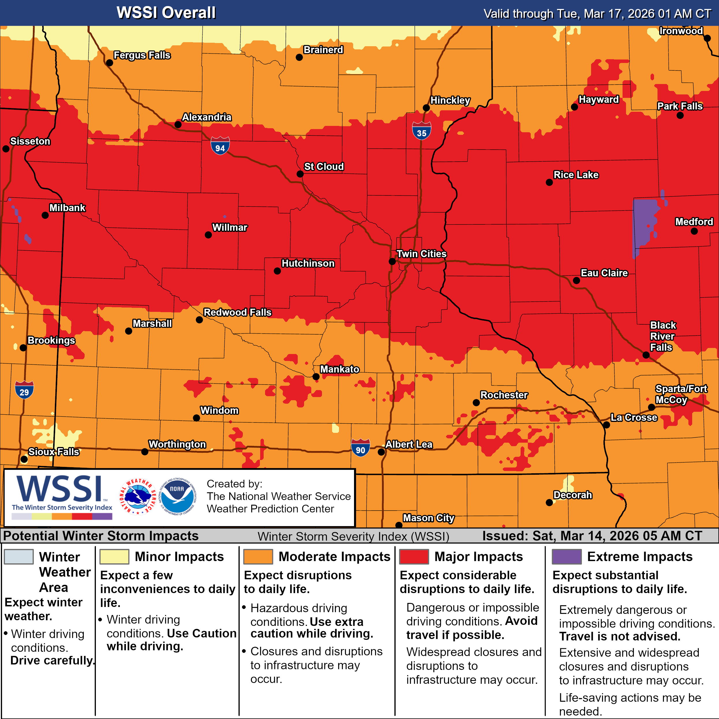
A major winter storm system will move across the Upper Midwest late Saturday into Sunday, bringing a large swath of heavy snowfall across Minnesota and Wisconsin.
As the system has shifted north, the axis of heavy snowfall has now put its crosshairs over the Twin Cities Metro, including Dakota, Scott, Goodhue, Hennepin, Ramsey, Washington, Carver, Sherburne, and Isanti, where snowfall totals of 12 to 18 inches are expected, with up to one-tenth inch of sleet possible in the south metro late tonight.
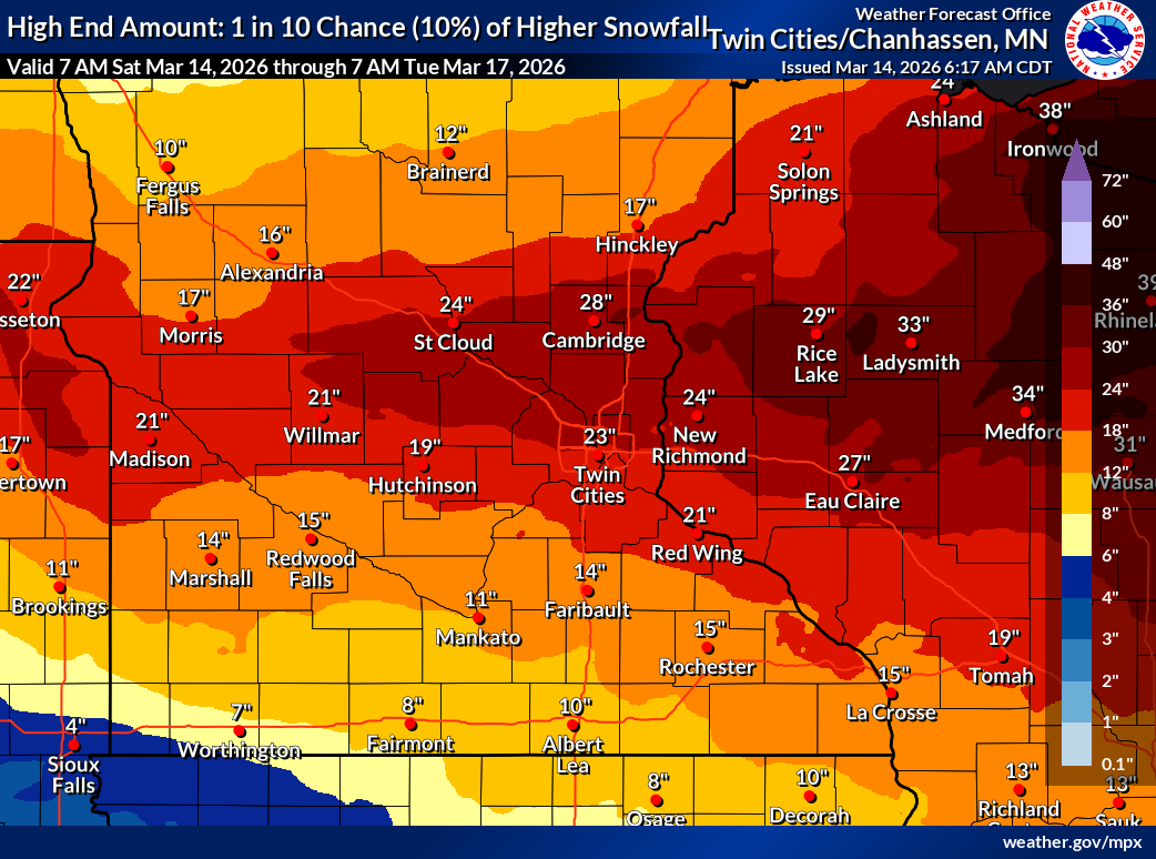
A broader area of 8+” is expected across the Upper Midwest, with most seeing 10 to 16 inches of snow, with a narrower corridor potentially receiving 20+ inches. The higher totals are more likely across southeastern MN into western WI.
The heaviest snowfall is expected Saturday evening through early Sunday morning, with snowfall rates potentially reaching up to 2 inches per hour, which could quickly overwhelm road crews and lead to rapidly deteriorating travel conditions.
Strong Winds Could Create Blizzard-Like Conditions
While the snow will begin to taper off on Sunday, strong winds are forecast to increase significantly, creating blowing and drifting snow.
Winds Saturday night: Northeast 20–30 mph
Winds Sunday: Northwest 35–45 mph with gusts up to 40–45 mph
These winds could cause whiteout conditions at times, especially in open areas and along rural highways. Blowing snow may also reduce visibility across the Twin Cities metro and southern Minnesota. The combination of heavy snowfall and strong winds could produce periods of blizzard-like conditions on Sunday, particularly across western and southern Minnesota.
Travel Could Become Dangerous or Impossible
Officials warn that road conditions could deteriorate rapidly as the storm intensifies Saturday night. Travel may become very difficult or impossible late Saturday night and throughout Sunday, with blowing snow reducing visibility and creating hazardous driving conditions. Upgrades to a Blizzard Warning are possible.
The storm is also expected to impact the Monday morning commute, especially if snow and drifting continue overnight Sunday.
Drivers are urged to monitor conditions before traveling and check Minnesota road conditions through 511 or at 511mn.org.
Heavy, Wet Snow Could Cause Additional Hazards
Another concern with this storm is the high moisture content in the snow, which is expected to be heavy and wet. This could lead to:
Tree branches breaking
Possible localized power outages
Difficult and potentially hazardous shoveling conditions
Officials advise residents to pace themselves when clearing snow to avoid overexertion.
Safety Tips for Residents
The National Weather Service recommends residents prepare ahead of the storm by:
Avoiding unnecessary travel during the storm
Keeping emergency supplies in vehicles, including food, water, blankets, and a flashlight
Monitoring updated forecasts and warnings
Preparing for potential power outages
Clearing snow in stages to avoid injury from heavy snow
What to Expect
Saturday Evening: Snow begins and quickly intensifies.
Saturday Night: Heaviest snowfall with possible 2-2.5”/hr snowfall rates.
Sunday: Snow tapers, but strong winds create blowing snow and near-blizzard conditions.
Monday Morning: Lingering impacts likely for the morning commute.